Nature
 PUBLISHED


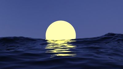


The sky and sea are often seen as at odds. Both blue, both symbols of exploration and adventure that lie just beyond the horizon, both alien worlds. They are places of mystery, of danger, where the physical limits of our human form are put to the test, with some places that can only be explored with robots.
Despite the similarities, culturally, we have pitted them against each other. We often hear that we know the surface of the Moon or Mars better than we know our own ocean, with the implication that we do not know all that much about what goes on under the waves.
While certain celestial bodies have been mapped extensively, and even at higher precision than the bottom of the sea, the reality has crucial complexities that are worth exploring. And we will see that the choices to explore often depend on technology and money, not just our willingness to go there.
The ocean takes an early advantage
Maps of the rocky bodies in the Solar System, such as the Moon, Mercury, Venus, and Mars, are available in higher resolution compared to the maps of the global ocean floor – this is a fact. But the incredibly high resolutions of these maps are from recent years – whether we are talking specifically about the data, the analysis, or both. The discussion of whether we know space better is much older, even though space observations have only recently dramatically surpassed ocean mapping.
What I soon discovered from my scientific team was that we actually didn't know where the bottom of four of the world's five oceans were.
Victor Vescovo
Ocean mapping under the General Bathymetric Chart of the Oceans (GEBCO) started in 1903, aiming to create a map of submerged structures on the ocean floor.
For decades, this map had no need for celestial comparison. We simply didn’t know much about the heavens. Consider that sonic and ultrasonic devices were already being used between 1912 and 1931 for the second edition of GEBCO. We didn’t even know other galaxies existed for most of the time it was being filled.
It was in 1982 that we could make a more interesting comparison. The fifth edition of the world ocean map was released with a scale of 1:10 million. By that point, space mapping had already become much better… at least when it came to the Moon.
The US Geological Survey used data from the Apollo missions to create a number of geological maps of the Moon, including a global map at the scale of 1:5 million. This level of detail was beaten in 2024 by the Chinese Academy of Sciences (CAS), which released the highest-resolution geological map of the Moon yet: the Geologic Atlas of the Lunar Globe with a 1:2.5 million scale.
These global maps can be good, even very good, but it is all relative. The Earth’s ocean floor is known in an approximate way at best. Good enough if you want an idea, but if you are interested in the detailed structure, you are out of luck.
“Trying to dive to the bottom of all five of the world’s oceans was extremely challenging. No one had ever done it before, ever really attempted it. I thought the major challenge would be helping design, construct, and then piloting the actual submersible that could do it,” explorer Victor Vescovo told IFLScience's The Big Questions podcast.
Vescovo is one of the very few people to travel to the bottom of the Mariana Trench (the deepest part of the ocean we know of) and reach space in a sub-orbital flight with Blue Origin in 2022.
“What I soon discovered from my scientific team was that we actually didn't know where the bottom of four of the world's five oceans were.”
For that unique adventure, Vescovo and his team mapped the ocean around their area of interest. They are involved in GEBCO and the Seabed 2030 initiative, which aims to map all the ocean floors to a resolution of at least 100 meters (328 feet) by 2030. That would take it to the level of resolution of NASA’s best map of the Moon, created from the Lunar Reconnaissance Orbiter in 2017. Not incredibly far behind.
The main issue is that it is a massive endeavor to map the sea floor. Currently, about three-quarters of it remains unmapped to a sufficient resolution. That’s about 300 million square kilometers (116 million square miles) of unmapped seabed surface.
Still, progress is happening fast. In 2017, the area mapped to modern standards was just 6 percent. This fraction of mapping is done with sonar – the part that humans have seen, even with remote cameras, is actually much smaller.
Space comes into its own
This is part of the crux. If we can see it, then we can more easily map it – and if we can do that automatically, it is even better. This is why space has such an advantage.
Missions around Mars and Mercury have collected hundreds of thousands of photos that can be stitched together to create better and better maps of the planets. Mercury has a global mosaic of images at 665 meters per pixel. Mars is known to an even higher resolution, reaching 5 meters per pixel, creating a 5.7 trillion-pixel image of the planet.
But maybe a fairer comparison is Venus. We can’t directly see the surface of Venus due to its thick cloud coverage. Radar observations from the MAGELLAN mission between 1990 and 1994, together with advanced computer analysis, delivered a map with a resolution of 75 meters per pixel. Future missions to Venus will push that even further.
Space missions can simply go around and around, collecting data. So, the way to make ocean mapping easier would be to automate the process. For example, some satellite observations have been used to map coastal areas. In this way, researchers from the Greenwater Foundation, with the backing of Vescovo, produced new coastal mapping data across 14 different countries, totaling 217,560 square kilometers (84,000 square miles). Consistent with the Seabed 2030 goal, the average resolution was 100 meters (328 feet).
This approach to mapping costs $2 per square kilometer ($5.18 per square mile), about 10 times cheaper than what it costs to map the seafloor usually. If this level of affordability could be stretched everywhere, it wouldn’t take too much to cover the whole ocean.
Unfortunately, we can’t use satellites like that everywhere. Still, automation seems to be crucial, and Vescovo is designing solutions to make the mapping more economically feasible.
Can the deep sea catch up?
Coastal areas can be mapped with satellites. In regions close enough to the coast but where the water is too deep for light to penetrate – between 30 and 500 meters (98 and 1,640 feet) – automated drone boats can sail up and down, mapping as they go along, before going back to harbor. For the deeper oceans, Vescovo has something else in mind.
There is a good reason why we haven't mapped the seafloor: it's not worth that much directly, but I think in terms of a common good, it is.
Victor Vescovo
“That's where the ship that I'm designing, and hopefully will build in the next two years, will come to the fore," Vescovo says.
"With a crew of just one person, maybe two, it will effectively be a semi-autonomous ship that will go out for two to three weeks at a time and run large tracks with the most powerful mapping sonar you can put on a civilian vessel, the Kongsberg EM124. That is a sonar that can map thousands of square kilometers per day because that's what it's designed to do. And you have the depth to get a large swath of area."
Understanding the depths of the oceans can unlock better insights into the processes that govern our planet, but we are not yet a civilization that funds all science for science’s sake. Until then, some parts of space might continue to have the advantage in terms of higher resolution.
“There is a good reason why we haven't mapped the seafloor: it's not worth that much directly, but I think in terms of a common good, it is," Vescovo told IFLScience.
"From helping with navigation for ships so they don't run into sea mounts or shoals that they don't know about, to mapping the tidal areas and the ocean current areas to help with climate modeling, all of those are common goods that are hard to get funded, but if we make it cheap enough, maybe we are able to make it approachable."
In the coming decade, we will see improvements in both mapping the seafloor and rocky celestial bodies in the inner Solar System. Sure, space will maintain its edge in precision, but a win is a win, and hopefully, ocean mapping won’t rest on its laurels after Seabed 2030 is completed.
There is certainly more to know about the ocean. Even if we consider the ocean floor alone, it’s shocking how little we have directly observed. New research suggests 99.999 percent of the deep ocean (anything under 200 meters (656 feet) has never been observed by humans. The researchers estimate that there has been visual coverage of between 2,130 and 3,823 square kilometers (822 to 1,476 square miles). The area is only slightly larger than Rhode Island or one-10th of Belgium, out of all the oceans!
And it’s not just about the bottom of the ocean. It’s a three-dimensional environment with life and processes across so many depths; the significant efforts to study the seafloor are not the be-all and end-all, but a crucial step toward more insights into an “alien” environment we can briefly visit.
The mysteries of the oceans and the peculiarities of rocky celestial bodies are not at all antithetical, as they have been treated in conversation. They are regions that feel limitless (and for the universe, that might be true), but they are limiting to us and our tech. The call to explore these expanses remains, and humanity will continue to, even if it might take a little time.
This Deep Dive feature first appeared in Issue 37 of our digital magazine CURIOUS. To access exclusive CURIOUS content first and receive the quarterly digital magazine, become an All Access Member.