Nature
 PUBLISHED




Just how deep are the world's deepest oceans? Well, that depends on who you ask, the methods they used, and whatever the ocean was playing at on the day they gathered their data.
Despite measuring it at least four times, scientists still can't agree on the depth of the deepest point known on Earth: Challenger Deep in the Mariana Trench. A new measurement has come up with a different result, again.
Measuring the Challenger Deep is... challenging
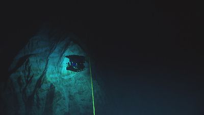
The Challenger Deep is home to the deepest known point of the seabed, located at the southern end of the Mariana Trench, an oceanic “Grand Canyon” at the bottom of the western Pacific Ocean.
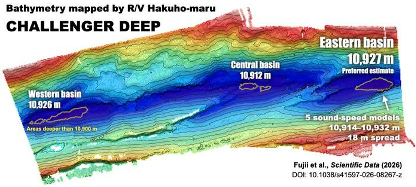
Its name doesn’t simply describe a single point on a map. Instead, Challenger Deep actually refers to three interlinked basins, with the central pool being the shallowest, followed by the western basin, then the deepest eastern pool.
Give it a quick Google and you’ll probably get an AI overview telling you that Challenger Deep is “approximately 10,935 meters (35,876 feet) or about 6.8 miles below the ocean surface.” The figure is likely taken from a 2021 study by NOAA oceanographers (although it's not immediately clear since LLMs are not keen on crediting the information they "summarise").
It's not necessarily incorrect, but it's not the whole story either. Why? Because even high-precision measurements in the 21st century can vary by a surprisingly large degree.
How to measure the deepest known point of the ocean
Scientists have been measuring the depth of the Challenger Deep since the 1950s, essentially using two different methods that have been honed and finely tuned over the decades.
One way is water pressure, although this requires sending a sensor down to the location you wish to measure.
Humans first reached the bottom of Challenger Deep's western basin using a deep-sea sub in 1960 – yes, over 65 years ago! – but it's not exactly the most convenient journey if you're primarily interested in measuring depth, rather than exploring the world's great unknowns.
Before that pioneering expedition, British and Soviet research vessels had relied on acoustic bathymetry, a method that sends sound waves down to the seafloor and times how long they take to bounce back. Because sound travels through seawater at a known speed, the length of that round-trip can be converted into a depth.
The technology has since evolved, but it is fundamentally the main way we learn about ocean depth today.
Since those early expeditions, Japanese researchers have made some of the most consistent and repeated measurements of this part of the western Pacific since the 1980s using a variety of methods, including acoustic bathymetry.
A new way to measure the ocean’s deepest point
At Challenger Deep, it takes around 15 seconds for sound to travel from the ship to the seafloor and back. However, it’s known that the speed of this journey can be subtly influenced by the sea’s temperature, salinity, pressure, and other variables.
To highlight this, a new study by Japanese scientists has shown how these different factors could skew depth estimates of the Challenger Deep.
The team developed five models with different oceanic conditions, then plugged in acoustic depth data that was gathered by research vessel Hakuho-maru in 2023.
The results showed that the varying conditions can dramatically change the depth estimates for Challenger Deep’s eastern basin, ranging from 10,914 to 10,932 meters (35,807 to 35,866 feet) — a considerable difference of 18 meters (59 feet).
The ambiguous results inspired the researchers to develop a “preferred” model that they felt provided the most realistic result.
It takes the original acoustic depth data from 2023, then combines it with temperature-and-salinity data of the upper 1,900 meters (6,233 feet) of the seawater, also measured during the same survey. Finally, it adds a full-depth profile acquired by the Hakuho-maru vessel in 1992, which details the deep-sea conditions of the region.
This combination pairs a timely reading from the upper ocean, where conditions tend to vary the most, with data from the deep water, which remains relatively stable over the years.
In sum, the extra bits of data gave them an estimate of 10,927 meters (35,849 feet) depth for the eastern basin of Challenger Deep.
So, is that the most accurate measurement of the ocean’s deepest point ever calculated? Wouldn't we be so lucky?
The authors stress that this is simply their preferred method for this particular dataset, not the final word on the deepest point on Earth. What it does show, however, is that you can't map the seafloor without also understanding the thousands of meters of ocean above it.
The new study is published in the journal Scientific Data.