Nature
 PUBLISHED
 2
2





What you'll discover in this article
- This year’s superstrong El Niño will have a major impact on weather across the globe.
- The current El Niño is young but already rivalling previous record-breakers.
- In an interview with IFLScience, a climate scientist from Berkeley Earth describes El Niño’s emergence in 2026 as “nuts” and “completely unprecedented.”
An El Niño event like nothing we’ve ever seen before is cooking in the Pacific. Its mounting strength is so unprecedented that climate scientists aren't even sure what impact it will have when it hits full tilt, but they say this “uncharted territory” should be a cause for concern.
What is El Niño? And why is 2026 so weird?
El Niño is a climate phenomenon characterized by warmer ocean temperatures across the central and eastern tropical Pacific Ocean, triggering a domino effect that has a broad influence on the weather across the world.
It's part of a cycle that wavers through three distinct phases every few years: El Niño (the warm phase), La Niña (the cool phase), and ENSO-Neutral.
Scientists officially declare the emergence of El Niño when sea surface temperatures in this part of the Pacific rise to at least 0.5°C above the long-term average. The US National Oceanic and Atmospheric Administration (NOAA) announced we had passed this threshold back in early June, just as models predicted.
However, this El Niño has continued to muster strength at a remarkable pace despite still being relatively young. In the first week of August, temperatures in the eastern Pacific were 2.6°C above normal.
If temperatures continue to rise on this trajectory, we're in for one of the hottest El Niño phases on record.
“It’s nuts how quickly the event is developing and how strong it is to date”
Zeke Hausfather
“To put it in perspective, anything above 2°C is considered a 'super El Niño.' So we're already, at least for daily temperatures, well within a very strong or ‘super El Niño’ territory,” Zeke Hausfather, a climate scientist at Berkeley Earth, told IFLScience.
“It’s nuts how quickly the event is developing and how strong it is to date,” he added.
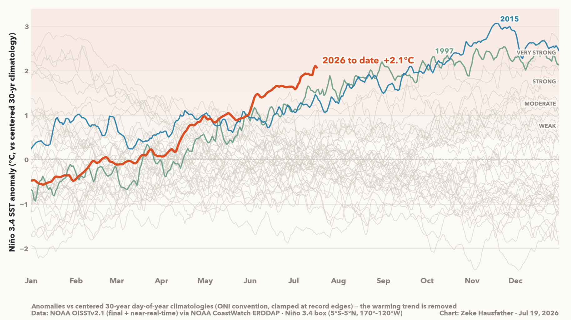
The best comparison we have is the record-breaking El Niño of 1997/98, the strongest event in recent memory, which cost the global economy trillions and killed thousands. However, as the graph above shows, this year's El Niño is currently charging ahead even of that year's trajectory.
“We haven't had El Niño anywhere near as strong as this before at this time of year. We're in uncharted territory as far as that goes,” explained Hausfather.
Will the skyrocketing temperature line taper off early in a slightly different trajectory from previous years? It's a possibility, but most models suggest the current El Niño will go on to become the strongest on record, peaking late in 2026.
The global impact
All of this is set to have a profound impact on climate and weather across the globe. The most significant effect of El Niño is an increase in global temperatures, leading to more frequent heatwaves, disrupted rainfall patterns, and an elevated risk of drought in some regions alongside severe flooding in others.
However, the phenomenon affects different parts of the world in many other, subtler ways. In the US, El Niño typically pushes the jet stream south, bringing wetter conditions to the Gulf Coast and Southern California, milder and drier winters to the Pacific Northwest and northern states, and reduced Atlantic hurricane activity due to increased wind shear.
Elsewhere in the world, these changes can be more severe.
“In the tropical Pacific, we tend to get drier conditions. Indonesia, Southeast Asia, Eastern Australia, Southern Africa, the Northern Amazon, and India tend to be drier and have a weaker monsoon. Those are probably, of all the effects of El Niño, the ones I'd be most concerned about because they have a big impact on agricultural yields,” noted Hausfather.
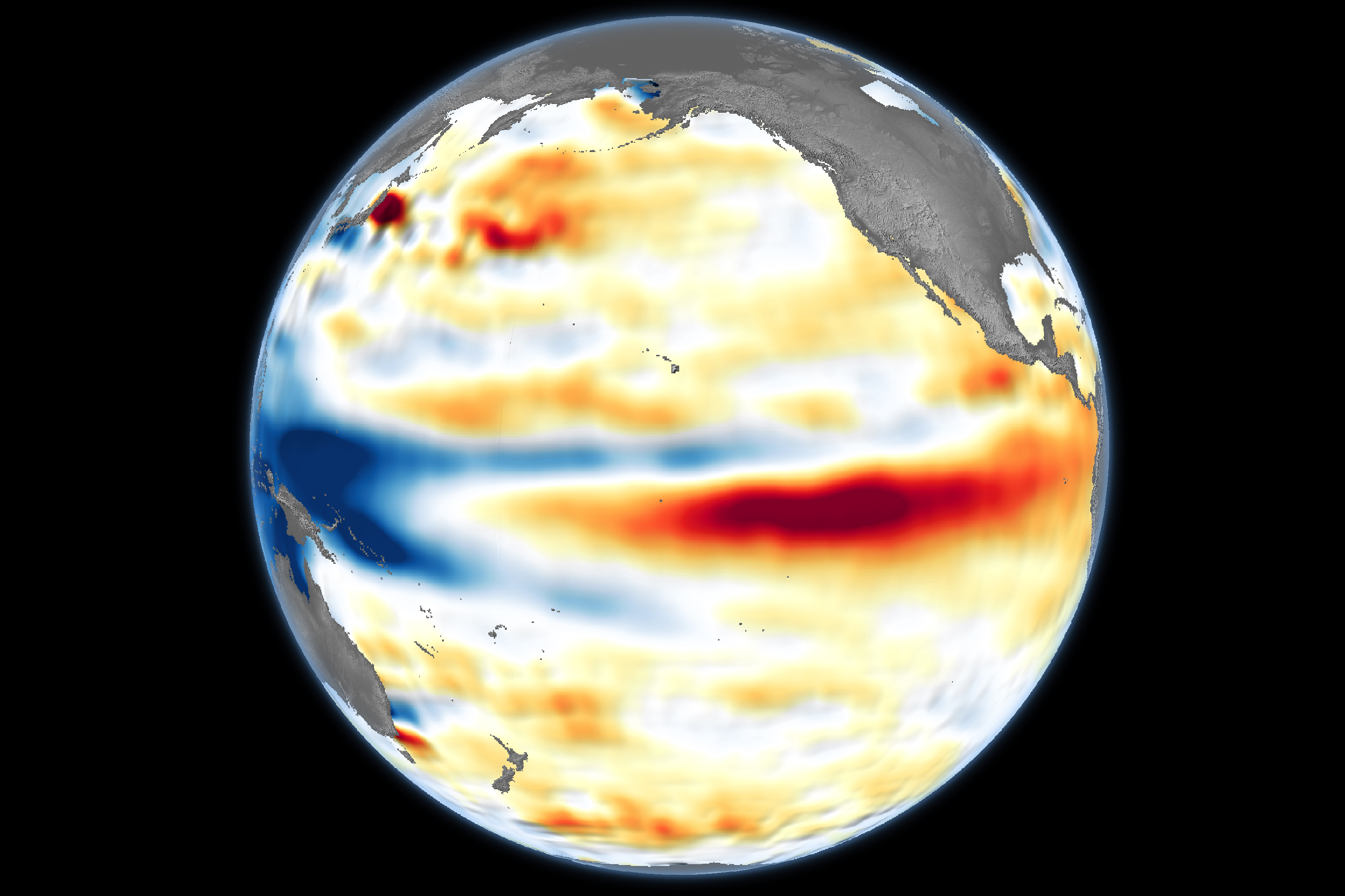
These impacts were made starkly clear in the 1997/1998 El Niño event, where thousands of people died across the world from flooding, drought, famine, fires, extreme heat, and disease outbreaks.
It's also likely to spark record-breaking coral bleaching around the world, dealing a devastating blow to the planet's already struggling reefs.
The first globally synchronous coral bleaching event occurred in 1998, coinciding with the strong El Niño. Since then, nearly every strong El Niño event has triggered a new wave of global coral bleaching.
Known unknowns
There’s no telling yet whether 2026 will be anywhere near as catastrophic as 1997/1998, partially because scientists have little idea of how the rest of the story might pan out.
"This event is so far outside of anything we've experienced before"
Zeke Hausfather
“I don't want to be overly alarmist about it, but I think we should be preparing right now for something that we have never seen before,” said Hausfather.
“I hope countries, particularly in the tropics, are already starting to prepare for reduced harvests and the impacts that'll bring. I don't think we can be complacent, particularly because this event is so far outside of anything we've experienced before,” he added.
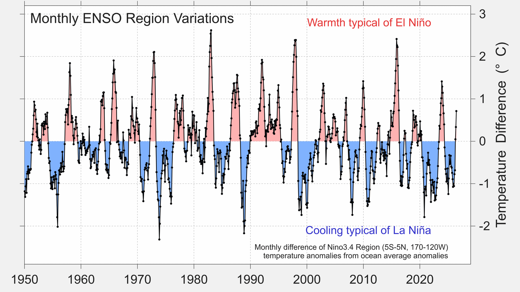
Another reason it's difficult to draw direct comparisons with El Niño of 1997/1998 is that Earth was a very different place just 28 years ago. In 2026, the planet is considerably warmer than it was in previous decades as a result of climate change, adding an additional sting to El Niño phases.
“1998 was a record-shattering year at the time for temperatures. If it occurred today, it would be exceptionally cold. That puts in perspective how much human contribution has changed things in addition to things like El Niño,” continued Hausfather.
“The last time we had a year as cold as 1998 was 2011. Every year since 2011 has been hotter than 1998,” he added.
This rapidly changing baseline is precisely what fuels the misconception that any extreme weather can be shooed away as "just El Niño" and swept under the rug. Hausfather pushes back firmly against that framing and, instead, believes that these events only further highlight the perils of climate change.
“There's a certain class of very online climate sceptics who are like ‘oh, it's all El Niño, you're just blowing natural variability out of proportion.’ But no, El Niño just gives us a sneak peek at what the new normal is going to be a decade from now,” he warned.