Nature
 PUBLISHED


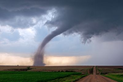


Your phone beeps. It’s a warning from your local weather service: there’s a tornado headed for your town, and you have 20 minutes to seek shelter before it hits. You pause your video game; switch off the stovetop flame halfway through cooking dinner; whatever you were doing, you stop, and head for the basement. Why, you might gripe as you make your way down, could you not have been given more time to prepare?
Here’s the thing: as far as modern technology and scientific knowledge has come, tornado forecasting remains stubbornly opaque. “There are known unknowns, and there are unknown unknowns,” Rich Thompson, Chief of Forecast Operations at the Storm Prediction Center, tells IFLScience, “and the best forecasters at least have […] an idea of what [they] don't know. But you can't fully know what you don't know because you don't know it yet.”
Tornado research is a surprisingly new and constantly changing field of research – sometimes being updated in real time as some meteorologist on the ground notices something odd and thinks, “Huh. Wonder what that’s about?” Those who forecast the events are working with spotty theory, and often even spottier data; tornadoes that could occur mostly don’t; increasingly, those being reported by the public are of a strange type whose genesis can’t be seen on radar at all.
The question, in short, shouldn’t be “why can’t we do better?” – it should be “how does this work at all?”
What we know (and what we don’t) about tornadoes
Generally speaking, there are three types of tornado. First, there are the supercells – those huge, catastrophic tornadoes, borne out of thunderstorms so powerful they start to create their own atmospheric systems within themselves. Those are “the longest-lived tornadoes,” explains Thompson, “and generally the most intense.”
How these tornadoes occur is pretty well-understood – to a point. “One of the first ingredients we're looking for is what we call wind shear in the atmosphere,” Thompson tells IFLScience. “[That is,] changes of winds in direction and height.” Given the right – or perhaps, wrong – mix of wind speed at various heights, air starts to rotate and rise within the storm, being continually fed by warm, moist air from the ground. At that point, you’ve got everything you need for a tornado to form.
We know a lot about the conditions under which tornadoes form, but we still don't know why one storm will produce a tornado while the storm next to it doesn’t.
David Sills
So it’s kind of confusing, even to the experts, that it doesn’t always happen. In fact, only something like one in five supercell thunderstorms actually produce a corresponding tornado: despite having all the right ingredients, clearly something’s going wrong in the mixing. And what that is, exactly, is “still a mystery,” says David Sills, Director of the Northern Tornadoes Project (NTP) at Western University, Ontario, and deputy director of the Canadian Severe Storms Lab within the NTP.
“We know a lot about the conditions under which tornadoes form,” he says, “but we still don't know why one storm will produce a tornado while the storm next to it doesn’t.”
If you can believe it, that’s the best-case scenario. Next, we have the non-supercell tornadoes: the squall lines – more technically known as quasi-linear convective systems or QLCSs – and the landspouts. These are even harder to predict, partly because they’re small enough to slip through the cracks in the radar: “We only have spotty observations,” Thompson says. “We don't know exactly what the environment looks like everywhere all the time.”
More problematic, however, is noticing any warning signs of a non-supercell tornado at all – because even with the best data, the fact is that they just don’t really have them. “It drives the weather service crazy, because they appear all over,” says Sills. “There's no rotation that you can see on radar, so they're very hard to predict.”
“But you know, they’re still dangerous,” he adds. “Even though they’re weaker, people could [still] get injured or killed. Property damage can still happen.”
Holes in the data
With so many unknowns – and such severe repercussions for potential mistakes – it’s no surprise that improving tornado prediction is an active field of research right now. Canada recently updated and expanded its national weather-radar network – albeit only to disband the research teams that received and interpreted the data just this month; the US system is older, but with that comes a vast resource of data from almost four decades of use. “They’ve squeezed every ounce of value out of those radars, and the data that come out of them are excellent,” Sills tells IFLScience. “So the forecasters have got a leg up because of that.”
Still, the system isn’t perfect. “There's a large spectrum of information I would like to have,” says Randy Bowers, a meteorologist at the Storm Prediction Center and something of an expert at gauging oncoming storms. “I personally would like to have observational data in the lower part of the atmosphere – not just the surface, but just that lower half mile to mile or so of the atmosphere. Temperature and wind characteristics, especially, and moisture characteristics, especially.”
There's days where, you know, somebody slams a car door in the Walmart parking lot and it sets off a chain of events that leads to an unexpected tornado somewhere hours or days later.
Rich Thompson
“Those, I think, would be very, very helpful,” he tells IFLScience. “We don't quite have that. We have to infer it from the model data.”
Such practical ambitions are just the tip of the tornado forecasting iceberg, though. Perhaps even more pressing is that most fundamental puzzle: what is it that makes some storms turn tornado, while others don’t?
“I've got a postdoc who's working on that exact question,” Sills tells IFLScience. “Trying to determine if there's something about the kind of environment that they develop in that will let us know whether [a storm] is going to be a big tornado producer or not. And we just don't know.”
It’s a question that, frankly, may never be answered. The dynamics of tornado formation are potentially so chaotic that to fully understand them would require a level of information that would be impossible to obtain. “When you get down to it, you literally need to know what every molecule of air is doing at the same time,” Thompson says, “which of course is outrageous.”
“There's days where, you know, somebody slams a car door in the Walmart parking lot and it sets off a chain of events that leads to an unexpected tornado somewhere hours or days later,” he tells IFLScience. “It's kind of scary if you stop and think about it.”
How to predict a tornado
With all these problems, it’s hard not to wonder how any forecaster can even hope to predict an oncoming tornado – and, to a certain extent, the answer is simply that they can’t. “Saying, like, that this tornado is going to last from 3.15 pm to 3.37 pm – we cannot do that right now,” admits Thompson. “We're not even particularly close to that.”
Evidently, though, tornado watches and warnings are issued, and with a pretty good accuracy rate. So what do meteorologists look out for?
Certainly, it’s not like standard weather prediction. Whether it will rain, or be cold, or sunny – those things are relatively simple to predict, insofar as any stochastic system can be simple. We’re pretty good at it now: we can forecast these phenomena more than a week in advance, with relative accuracy, and so reliably that most people don’t even realize what an incredible feat of math and computing that really is.
With tornadoes, though, you’re really talking minutes of notice, rather than days. “No one's going to issue a tornado warning without some indication that it's either starting to occur, or occurring [already],” says Sills. Newer radar networks can pick up the difference between a simple rainstorm and one with hail or debris in the air – “but at that point, it's a little late to be issuing the tornado warning,” he points out.
The best way to predict an oncoming tornado, therefore, is to keep an eye open for cyclones. “With the supercell thunderstorms in particular, because it's a rotating thunderstorm, radar can detect that rotation – the precipitation that's rotating in the storm,” explains Sills. “Often, that rotation occurs before the tornado occurs.”
“That’s why doppler radar networks are installed across North America,” he tells IFLScience. “It’s just for that reason, basically: to try to see the rotation before the tornado occurs.”
Outside of that, it’s really a matter of probabilities. Most of the details of tornado formation are either too mysterious or too fiddly to rely on in the same way: “You may have a situation where you have, say, the middle of the parts of the storm rotating fairly rapidly,” explains Bowers, but “will that translate down to the surface? There's no real way to know for sure.”
So meteorologists work in refinements. First, they note that a tornado is possible in a certain area – likely one spanning hundreds of miles across – and issue a tornado watch. That’s not the difficult part, exactly – for supercells, at least. “We can see them coming days in advance now,” Sills says. “We can get a good idea of the time, the day, the general location.”
As the clock ticks down, and the tornado gets closer to forming, those details of when and where it might hit get less and less fuzzy, he explains – “but trying to forecast, you know, the exact location, the exact time, and the intensity is very challenging.”
That’s why the final weapon in the tornado forecaster’s arsenal is potentially the most important – and the hardest to obtain. “In some ways [it’s] an instinct, I guess,” says Bowers. “The more that you've seen, the more scenarios similar to that, the more comfortable you are making the warning decision.”
“Randy and I – I don't know how many thousands, or tens of thousands, of storms we've seen,” agrees Thompson. “It definitely helps building the experience, understanding, and observing all of the ways things can evolve as you anticipated – and especially all the ways that you didn't anticipate.”
Chasing the storm
If direct experience with tornadoes is helpful from behind a screen, it’s a veritable boon in the field itself. Yes, 1996's Twister was more accurate than you thought. “The first storm chase that I went on was in the fall of 1985,” says Thompson. “And I've been chasing every year since then.”
It’s not for fun. Well, not entirely for fun – “I've been interested in storms since I was a little bitty kid,” Thompson admits, “and I just, I enjoy seeing them.” But it serves an important purpose, too: “I have [gone storm chasing],” says Bowers, “and I would say yes, it does help for sure […] It helps build that conceptual model more completely.”
When you chase [tornadoes] it all kind of comes together, it all clicks.
David Sills
It’s a viewpoint echoed by all three meteorologists: that as good as radar data can be, there’s simply no substitute for seeing a tornado form in front of your eyes. “You can actually visually see the evolution of the storm more completely,” Bowers explains, “because you may only get a radar image every, you know, 2 to 5 minutes, and there's a lot that happens in that time frame.”
But seeing a tornado in action doesn’t only contextualize the information we can measure right now – there’s always the chance it could lead to a breakthrough nobody saw coming. “I know it's helped with applied research,” says Thompson; “like, ideas that [sprout from] ‘hey, I want to follow up on this because I've seen it with my own two eyes. I know that this matters. I've seen it repeat’.”
“The question is, okay, what does it translate to into,” he says. “[Is it] something that's an observable quantity that we could reproduce in a forecast sense?”
It’s an exciting and undeniably high-stakes research method – one that all three warn amateurs against attempting, particularly with modern instrumentation making it so easy to accidentally get too close to the danger. But it’s also seemingly irreplaceable for meteorologists hoping to better understand tornadoes. “Every time I go out there, I learn more about how tornadoes form and how it differs from what you see the textbook,” agrees Sills.
“When you chase it all kind of comes together, it all clicks,” he says. “You can put together the things you see on radar, the things you see in textbooks, and what you see in reality – and you just have a much better understanding of how it all works.”