

The World Meteorological Organization (WMO) has issued a fresh warning that El Niño – the climate phenomenon that drives up global temperatures – is likely to return this year, and it could pack a punch. The organization says now is the time for planning, decision-making, and preparedness to avoid the worst possible outcomes.
On Tuesday, an update from the WMO said there’s an 80 percent likelihood of an El Niño event during June–August and a 90 percent chance of El Niño conditions in the months from July to November.
The strength of the event is trickier to predict, but the statement said it will be “at least moderate – and possibly strong.” While often dubbed a "Super El Niño" in popular media, professional organizations like the WMO, which is part of the UN, generally stick to more sober language. But if you hear that term floating around social media, this is what they're referring to.
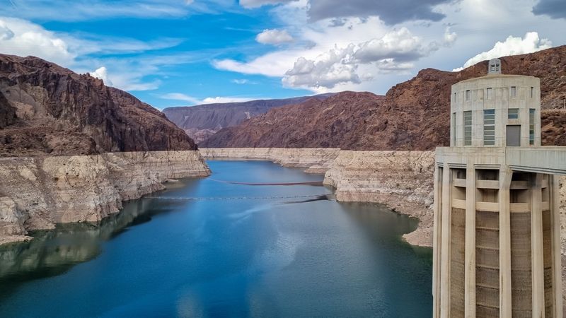
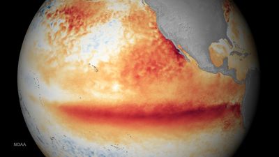
The predictions are based on sea-surface temperature in the central-eastern Pacific Ocean around the equator. Between late April and mid-May, meteorologists noticed temperatures exceeding 6°C (10.8°F) above average in this part of the ocean, suggesting El Niño was nigh.
You can learn more about what exactly El Niño entails right here, and it isn’t just about warmer conditions in the equatorial Pacific. The changes in temperature and pressure have a knock-on effect felt across the world, influencing everything from rainfall and droughts to tropical cyclones, heatwaves, and more.
How will El Niño impact the weather?
El Niño's effects vary from region to region. For the US, the south of the country is likely to see wetter conditions, while the north could experience warmer, drier weather.
Over in Australia, El Niño is typically associated with hotter and drier weather, significantly increasing the risk of droughts, heatwaves, and bushfires.
One of the most significant and predictable effects is on global average temperatures, which are pushed higher as a result of El Niño’s warming influence. Some scientists are already hedging their bets that 2026 will rank among the warmest years ever recorded – if not the warmest – not least because of El Niño’s influence on heat.
 how El Niño might influence drier or wetter weather in different parts of the world.")
“The science is clear: El Niño is arriving on our doorstep in the coming months with 90 percent certainty. The world must treat it as the urgent climate warning it is. El Niño conditions will pour fuel on the fire of a warming world,” said UN Secretary-General António Guterres, in a video statement.
“Impacts will hit even harder, travel even farther, and cross borders with devastating speed. The only effective response is climate action equal to the crisis – ending the addiction to fossil fuels, accelerating the shift to renewables, protecting the most vulnerable, and delivering early warning systems for all,” he added.
The worst El Niño ever?
We already have some idea of what's at stake. The historic 1997–1998 El Niño proved just how catastrophic these cycles can be. For 13 months, a powerful El Niño triggered relentless floods that devastated Asian agriculture, while surging waterborne diseases swept through Africa and South America. By the time it subsided, it is estimated that the extreme weather contributed to the deaths of 23,000 people and bled $5.7 trillion from the global economy.
There’s no guarantee this year’s event will be as severe as that record-breaker, but the WMO says it is imperative that countries around the world continue to monitor the situation and brace for the worst.
“We need to prepare for a potentially strong El Niño event – which will exacerbate drought and heavy rainfall and increase the risk of heatwaves both on land and in the ocean. The most recent El Niño, in 2023-24, was one of the five strongest on record, and it played a role in the record global temperatures we saw in 2024,” said Celeste Saulo, Secretary-General of the WMO.
“The WMO community will be carefully monitoring conditions in the coming months to inform decision-making by governments, humanitarian agencies and climate-sensitive sectors. Advance seasonal forecasts and early warnings are vital to save lives and cushion the impact on our economies and our communities,” said Saulo.