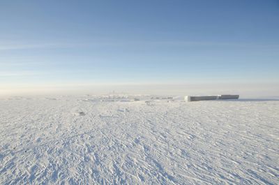
Up to 98 percent of Antarctica is caked in miles-thick ice sheets, some of which formed millions upon millions of years ago. Beneath this layer of frozen water, there lies a rugged, rocky continent just as diverse as any other. In a new project, scientists have sought to map this hidden world, revealing vast canyons and towering mountain ranges.
An international team of researchers, led by scientists from the University of Edinburgh, used a mapping technique called Ice Flow Perturbation Analysis (IFPA), which looks for shapes in the glacial surface to judge the shape of the hills and valleys beneath. This data was then paired with the latest satellite observations to create a detailed map of the Antarctic land under the ice.
“Because making scientific observations through ice is difficult, we know less about the landscape hidden beneath Antarctica than we do about the surface of Mars or Venus,” Dr Helen Ockenden, a former PhD researcher at the University of Edinburgh, currently based at L'Institut des Géosciences de l'Environnement, said in a statement.
“So it’s really exciting that this new method allows us to use satellite measurements of the ice surface to fill all of the gaps in our maps, revealing new details about mountain ranges, canyons, and geological boundaries,” Ockenden said.

This is far from a boring landscape, devoid of landmarks and interest. Remarkably, Antarctica has some of the lowest points on any of Earth's continental plates. Beneath the Denman Glacier in East Antarctica, there’s an ice-covered canyon where the bedrock reaches approximately 3,500 meters (11,500 feet) below sea level. There's also the Bentley Subglacial Trench, a valley in West Antarctica some 2,555 meters (8,382 feet) below sea level.
Meanwhile, Antarctica is also home to mountain ranges hidden beneath thousands of meters of ice, some of which scientists are only just discovering. But along with these massive peaks and troughs, the continent has vast open plains and flat beds.
“Over millions of years Antarctica’s ice sheet has sculpted a landscape consisting variously of flat plains, dissected plateaus, and sharp mountains, all hidden under the present miles-thick ice cover. With this technique we are able to observe for the first time the relative distributions of these highly variable landscapes over the whole continent,” explained Professor Robert Bingham, study co-author and geophysicist at the University of Edinburgh.
These attempts to document Antarctica’s landscape under the ice sheets aren’t just good for map makers and polar explorers. As the world warms, these colossal reservoirs of frozen water will melt and break down, contributing to sea level rises. The better we understand these subglacial topographies, the more accurately we can predict how ice will flow and melt in a changing climate.
“Understanding the landscape beneath Antarctica is really important for ice-sheet models. In particular, rougher areas with more hills can really slow down the retreat of the ice sheet, and so this new map will help our models to produce better projections of where and how much sea levels will rise in the future,” notes Professor Mathieu Morlighem, co-author from Dartmouth College, US, in a statement emailed to IFLScience.
The study is published in the journal Science.