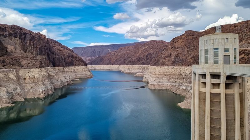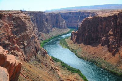


The Colorado River is among the most famous, significant, and culturally iconic bodies of water in the United States. But did you know that this enormous river once disappeared from the geological record for 5 million years? New research has now explained what happened to it and where it went.
Today, the Colorado River is one of the main rivers in the Southwestern United States and northern Mexico. At an impressive 2,330 kilometers (1,450 miles) in length, it is the fifth longest river in the US and is fed by many tributaries that make up the Colorado River Basin. Far from just being a natural feature in the landscape, the river is a source of life for a large variety of creatures that are dependent on its waters, including 36 million Americans.
But when it comes to this river’s ancient history, geologists have long puzzled over a key mystery. They knew the Colorado River existed in western Colorado 11 million years ago, they also know that it eventually exited the Grand Canyon around 5.6 million years ago. But the river largely disappeared from the geological record for the roughly 5 million years between these points. So, what happened here? How did this river navigate the terrain between the two points?
The new study suggests that, during this interval, the river flowed into an upstream lake just east of the Grand Canyon (where part of the Navajo Nation is now) and then pooled for several million years. It was only after this that the Colorado River flowed into the Grand Canyon for the first time. This spillover marked the river’s transition to a continental-scale river, eventually allowing it to connect the interior of the continent to the Gulf of California.
This was a transformative moment for the landscape.
“In some ways, you could really think of it as the birth of the Colorado River that we know today,” John He, first author and UCLA geologist, explained in a statement. “There are rivers everywhere, but a river that carries water and sediment across the continent connects life throughout the region, and the entire ecosystem probably changed as a result of the arrival of the Colorado River into the basin.”
The results are based on the analysis of sandstone samples that complement palaeontological evidence, such as fish fossils, indicating that life started to become part of an integrated ecosystem throughout the Colorado River basin during this missing chapter of its history.
The Grand Canyon was not created in a single phase, but rather was gradually carved by multiple phases across a long time. But when and to what extent the Colorado River contributed to this process remains debated among geologists.
“Geologists have proposed over a dozen hypotheses for the canyon’s formation and the Colorado River’s path,” John Douglass, co-author and a geologist at Paradise Valley Community College, added.
One hurdle in the prehistoric river’s path is the Kaibab Arch, a topographic high point located in northern Arizona and south of Utah. Geologists have devised various scenarios for how the river crossed it, but only one has been made more plausible by the new evidence: lake spillover. In this scenario, the Colorado River would have filled a lake before setting on its way to the Grand Canyon.
“Other processes, such as karst piping, which involves water transport through rock, and headward erosion, may have also contributed to the establishment of the river’s course,” Ryan Crow, corresponding author from the US Geological Survey (USGS), said. “Some reaches were likely newly carved, and others would have been significantly deepened by the integrated Colorado River over millions of years.”
Hunting missing time
The story of this research started when He, Douglass, and Emma Heitmann at the University of Washington met in the field while investigating the leftover deposits of Bidahochi Lake – an ancient lake on Navajo Nation land. Most of the deposits for this long-lost lake have eroded, limiting what we know about its size. Geologists are also unsure about the rivers that fed this ancient body of water or even why it disappeared in the first place.
To understand where the sediment of Bidahochi Lake came from, He hunted for zircons in the sandstone the team collected from the site. These are microscopic crystals that form in cooling magma. Zircons don’t degrade or change much across time so are great geochemical signatures for the moment they were created. The unique age and history of each crystal can therefore be used to learn the source of a sediment and to estimate when it was deposited.
Zircon is also found in granite and other volcanic rocks, so it is abundant in many sediments after the rock it formed in has eroded.
Using a technique called detrital zircon geochronology, which uses lasers or ion beams, geologists are able to measure the ratios of uranium and lead isotopes in hundreds of zircons in a sample. The age spectrum derived from hundreds of zircon samples – called its detrital signature – can be used to learn the source of a deposit and when it was laid down.
“Zircons are some of the oldest fragments of our Earth,” He said. “They’re like little time vaults, and by looking at the age and geochemical signature of zircons, we can tell where a sediment that has been moved by a river originated.”
The geologist was studying these signatures when he noticed what he thought was the signature of sediments known to have been deposited by the Colorado River. Surprised, he brough this data up with Douglass who, it turned out, was also looking for it along with Crow and colleagues at the USGS.
They decided to team up and, with other USGS geologists and colleagues from the Arizona Geological Survey, the University of Oklahoma, and the University of Washington, they started to compare detrital signatures. In particular, they compared those collected by He and Crow with known deposits of the ancient Colorado River. The results showed that signatures of the sediments deposited 6.6 million years ago in Bidahochi Lake closely matched those of other Colorado River deposits downstream and upstream. This included deposits at the Browns Park Formation in northern Utah and Colorado.
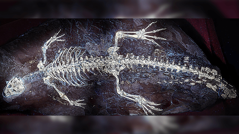
Rock layers from this time period show clear signs of rippling, suggesting a strong river flowed into standing water. At the same time, fossils of large fish species have been found there, which belong to species that lived in fast-flowing waters.
These converging lines of evidence strongly indicate that the Colorado River was supplying water and sediment to the Bidahochi basin before it spilled over. This set the stage for the water making its way into the Grand Canyon and then becoming the mighty Colorado River that carved much of that great landscape.
“I think there is something unique and disquieting when the planet’s history is laid out before our eyes, but we cannot fully read it. We’ve always known the Grand Canyon is there, this solid towering wall of rock, but we’re learning more each day how it formed,” He added.
The study is published in Science.