


 Nature
 PUBLISHED




When President Dwight D. Eisenhower was asked by John F. Kennedy why the Normandy landings at the end of World War II had been so successful, he replied "because we had better meteorologists than the Germans".
Though there were certainly other factors, a team of stressed-out meteorologists certainly played a large part in the success of D-Day. Weather observations and forecasts were not as "easy" back then as they are today, requiring data gathered from observations by ships and sent back via carrier pigeon, as well as crewed weather observation sites.
The Allies also had a key advantage, in that they had access to German weather reports and data, having cracked the Enigma code. While the Nazis had access to their own weather observations, the Allies had access to the German observations as well as their own data.
"The Allied charts contain a wealth of observations from across the UK and Europe. By contrast, the German charts reveal that they had been unable to crack the Allied codes," National Meteorological Archivist Catherine Ross explained to the UK's Met Office.
"As a result there are virtually no observations for the UK and surrounding waters. The difference in the information available to both sides gave the allies a crucial advantage on D-Day."
The Allies planned to land in Normandy in June. While they assembled nearly 160,000 troops to do so, the plan rested heavily on the weather, which had been particularly difficult to predict due to several unusually low pressures and frontal systems approaching Europe from across the Atlantic.
In short, the Allies needed a break in the storms in which they could cross the English channel, whilst conditions were still suitable for aircraft and ships for the journey.
The invasion also needed to take place before there was a clean break in the storm, which would allow the Nazis to see the giant forces amassing on the southern English coastline. Meanwhile, this break in the weather also had to match up well with suitable tides.
Captain J. M. Stagg, chief meteorologist to the Supreme Headquarters Allied Expeditionary Force (SHAEF), had the particularly stressful job of providing what might have been the most important weather report in history.
While the invasion had been planned for June 5, Stagg called it off due to the weather conditions. The role he had was clearly quite a lot of pressure, with him writing in his diary "I am now getting rather stunned, it is all a nightmare".
In fairness, the lives of over 100,000 people resting in your hands is not something you picture happening too often when you go into meteorology.
However, by monitoring the low pressure moving over the Atlantic, reported by ships located there, Stagg and his team identified a small window of opportunity where the Allies could launch their attack on June 6. On June 5, he wrote that there was a "final and irrevocable decision," adding, "whatever the outcome, the decision is taken".
According to President Truman, June 6 ended up being "probably the only day during the month of June on which the operations could have been launched”. Though it all went to plan and D-Day marked the beginning of the end of the war, it's difficult to portray exactly how narrow this weather window was.
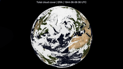
Using historical weather records, Professor Ed Hawkins of the University of Reading and forecasters from the European Centre for Medium-Range Weather Forecasting have made it a little easier to comprehend, turning these weather records into satellite-style imagery.
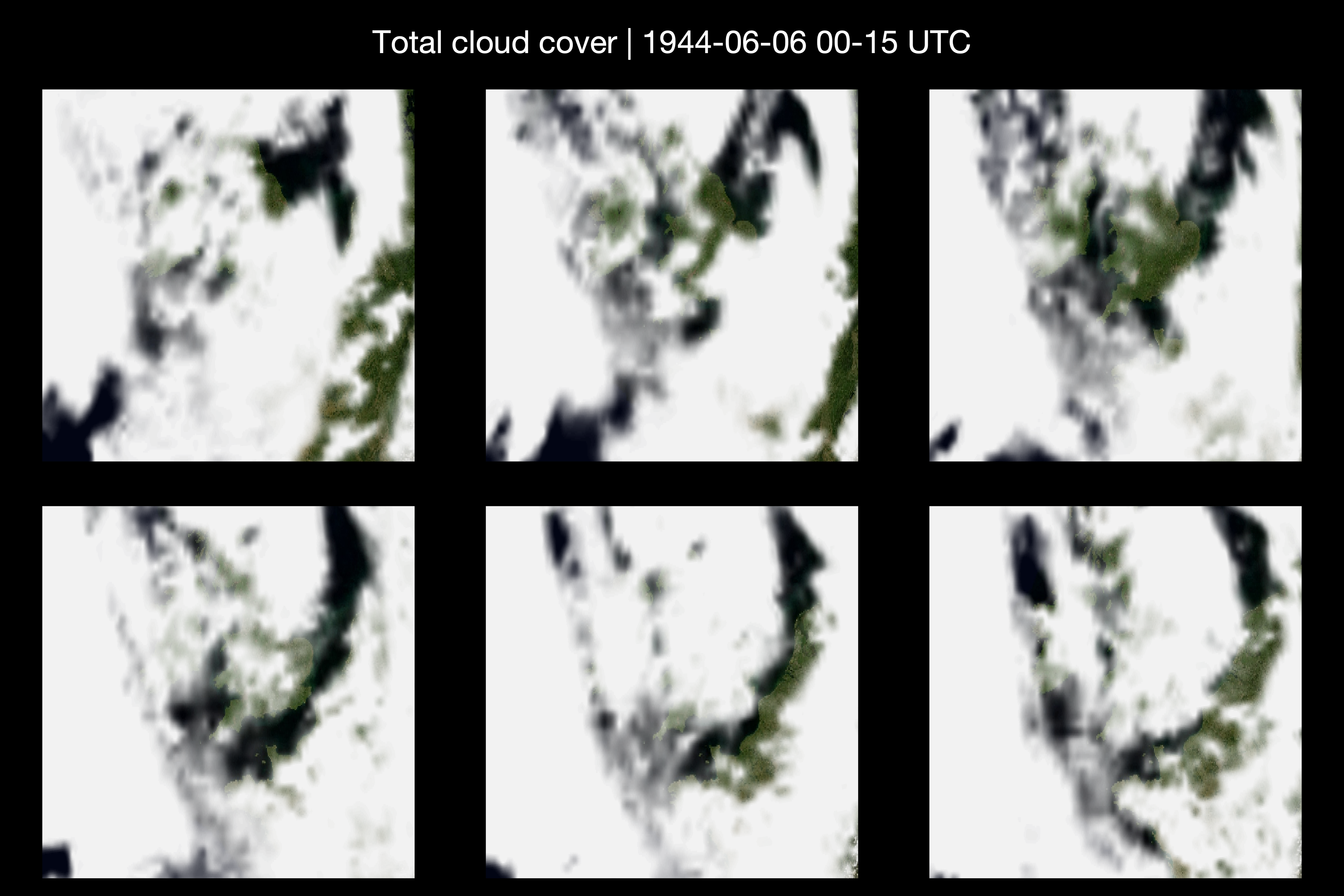
"Troops set off into a sky that was still breaking up after days of storms into a narrow window of better weather. A day earlier, or a few hours either way, and the weather could have stopped the invasion in its tracks, and changed the outcome of the war," Hawkins said in a statement.
"Images like this help us understand what troops, sailors and pilots actually faced that day, in a way written reports alone cannot. They show just how narrow the margin was between success and failure, and how much was riding on a small break in the cloud."
That break in the cloud, identified by meteorologists, changed the course of the war. Maybe go easy on the weather channel the next time you go outside with what turns out to be a completely unnecessary umbrella.




 1
1