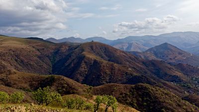


The Barberton Greenstone Belt in South Africa contains some of the oldest exposed rocks on Earth, some over 3.6 billion years old. It also contains some layers, a bit younger than that, which have perplexed geologists as they looked like a jumble of different rocks put together. Researchers now have a proposal: That portion is evidence of an ancient submarine landslide caused by an ancient quake.
If their theory is correct, this is the oldest evidence of an earthquake. The rocks are portions of an ancient and deep seafloor aged about 3.3 billion years. But among them, there are sedimentary rocks that could not have formed on the ocean floor. Those are rocks that formed either on land or in shallow water, such as barite crystals that formed as evaporites – rocks produced by the evaporation of water. Definitely not something that happens at the bottom of the sea.
So, the question is: how did those very different types of rock get together? Researchers Simon Lamb and Cornel de Ronde realized that the mix of rocks resembled the structures seen off the coast of New Zealand, where powerful earthquakes produce the sort of marine landslide that brings material from land and shallow water onto the deep ocean floor.
“We realised this map looked remarkably similar to a geological map (by Simon Lamb) made of the aftermath of much more recent submarine landslides. These were triggered by great earthquakes along New Zealand’s largest fault, the megathrust in the Hikurangi subduction zone,” the authors wrote in The Conversation.
“The importance of this lies in the fact that New Zealand’s geological record is uniquely created by the profound effects of large earthquakes in a subduction zone. This is still happening today, most recently in November 2016, when the magnitude 7.8 Kaikoura earthquake set off vast submarine landslides and debris avalanches that flowed down into deep water,” the authors continued. “We found the oldest record of these earthquakes, hidden in the highveld of southern Africa.”
This hypothesis is consistent with evidence from other regions of the world that plate tectonics and quakes from the motion of the plates started around that time. But there’s more. The Barberton Greenstone Belt shows evidence of underwater volcanism similar to the dramatic Hunga Tonga-Hunga Ha’apai volcanic eruption.
It is believed that the turmoil of our planet played an important role in the formation of life on Earth – although life might have predated the formation of tectonic plates.
A paper on this work is published in the journal Geology.
[H/T: The Conversation]