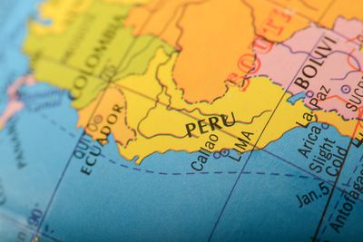


A strong earthquake, reported by the USGS as magnitude 7.2, has struck the region of Arequipa on the coast of Peru. The epicenter of the tremor was 54 kilometers (34 miles) southeast of the small town of Yauca according to the Instituto Geofísico del Perú. The quake hit just after half past midnight local time, causing fear and some building damage, but luckily no injuries have been reported.
The rest of this article is behind a paywall. Please sign in or subscribe to access the full content.The quake was felt all the way to Lima, the capital of the South American country which is 600 kilometers (373 miles) from the epicenter of the quake. There were some reports of a tsunami alert (although we couldn’t verify its origin as the US tsunami portal doesn’t have one). Peru's Prime Minister Gustavo Adrianzen confirmed that there is no tsunami risk at present.
Peru is a geologically active area. Much of the country formed as the Nazca Plate, the ocean tectonic plate to the west of South America, is slipping under the South American Plate in a movement known as subduction. The interaction between the tectonic plates has created the Andean Cordillera, the 6,500-kilometer (4,030-mile) long chain of mountains that fringes the west of the southern continent.
The subduction process is ongoing, and for this reason, Peru is susceptible to earthquakes – such as the 6.9 magnitude one that hit it in 2022. The most powerful quake recorded is also from the same crustal movement. It struck Chile on May 22, 1960, and it is estimated to be between 9.4 and 9.6 magnitude.