

As sea levels rise due to climate change, island nations like Kiribati are suddenly finding themselves on the verge of becoming modern-day Atlantises. However, new research reveals that in spite of this global oceanic swelling, the overall amount of land across the planet has actually increased over the past three decades, largely due to the drying up of lakes and the creation of new man-made islands.
A study in the journal Nature Climate Change analyzed the global gains and losses of both land and surface water between 1985 and 2015, using data from the Deltares Aqua Monitor, which draws on images collected by NASA’s Landsat satellites. Across this period, a total of 115,000 square kilometers (44,000 square miles) of land became submerged by water, while 173,000 square kilometers (67,000 square miles) of water was converted to dry land.
The Tibetan Plateau and the Amazon were identified as the areas that saw the largest conversion of land to water, while the Aral Sea in Central Asia saw the biggest loss of water. Once among the world’s largest lakes, the Aral Sea began to disappear when Soviet engineers diverted the rivers that feed it to irrigate local cotton and wheat agriculture in the 1960s. As a result, the lake has almost entirely dried up, with 27,650 square kilometers (10,675 square miles) of its surface water having vanished.
Increases in surface water on the Tibetan Plateau, meanwhile, are mostly caused by melting glaciers, resulting in the creation of small lakes dotted around the Himalayas.

Artificial islands like those off the coast of Dubai are responsible for an increase in global coastlines. Deltares
The researchers also caught a glimpse of some of the world’s unmapped regions, discovering that the Hwanggang Dam in North Korea has created a small reservoir in the Rimjin River, close to the border with South Korea. This same dam was at the center of a cross-border spat in 2009, when flash floods resulted in the deaths of several South Korean fishermen.
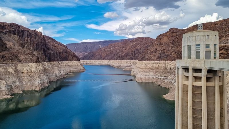
Lake Mead, which is currently the largest freshwater reservoir in the US, also shrunk considerably during the past 30 years, and the study authors suggest that a lack of inflow from the Colorado River is likely to cause the lake to disappear entirely.
Amazingly, coastal areas across the world have actually gained more land than water since 1985, mostly because of the construction of artificial luxury islands, such as Dubai’s audacious Palm Island. Overall, 20,135 square kilometers (7,775 square miles) of coastline have become submerged over the past three decades, while 33,700 square kilometers (13,010 square miles) of new coastal land have appeared across the world during the same period.