


 Nature
 PUBLISHED






Most afternoons, the same visitor arrives above the Tiwi Islands of northern Australia: Hector the Convector.
Like clockwork, this giant cloud looms out of the sky over the islands at the same time every day during the sultry “build-up” between September and December, then through the wet season itself, whenever the monsoon isn’t active.
Hector is a cumulonimbus thundercloud cluster — a giant, anvil-shaped, multi-level cloud that can bring heavy downpours, lightning, and strong winds. It hangs heavy in the sky, reaching heights of approximately 20 kilometers (66,000 feet), large enough to be seen from Darwin, over 100 kilometers (62 miles) away on the mainland, where it occasionally drifts.
It was named by pilots flying between Darwin and Papua New Guinea during World War II. Its appearance was so common and prominent that they used the charismatic cloud as a landmark to help them navigate and stay on course.
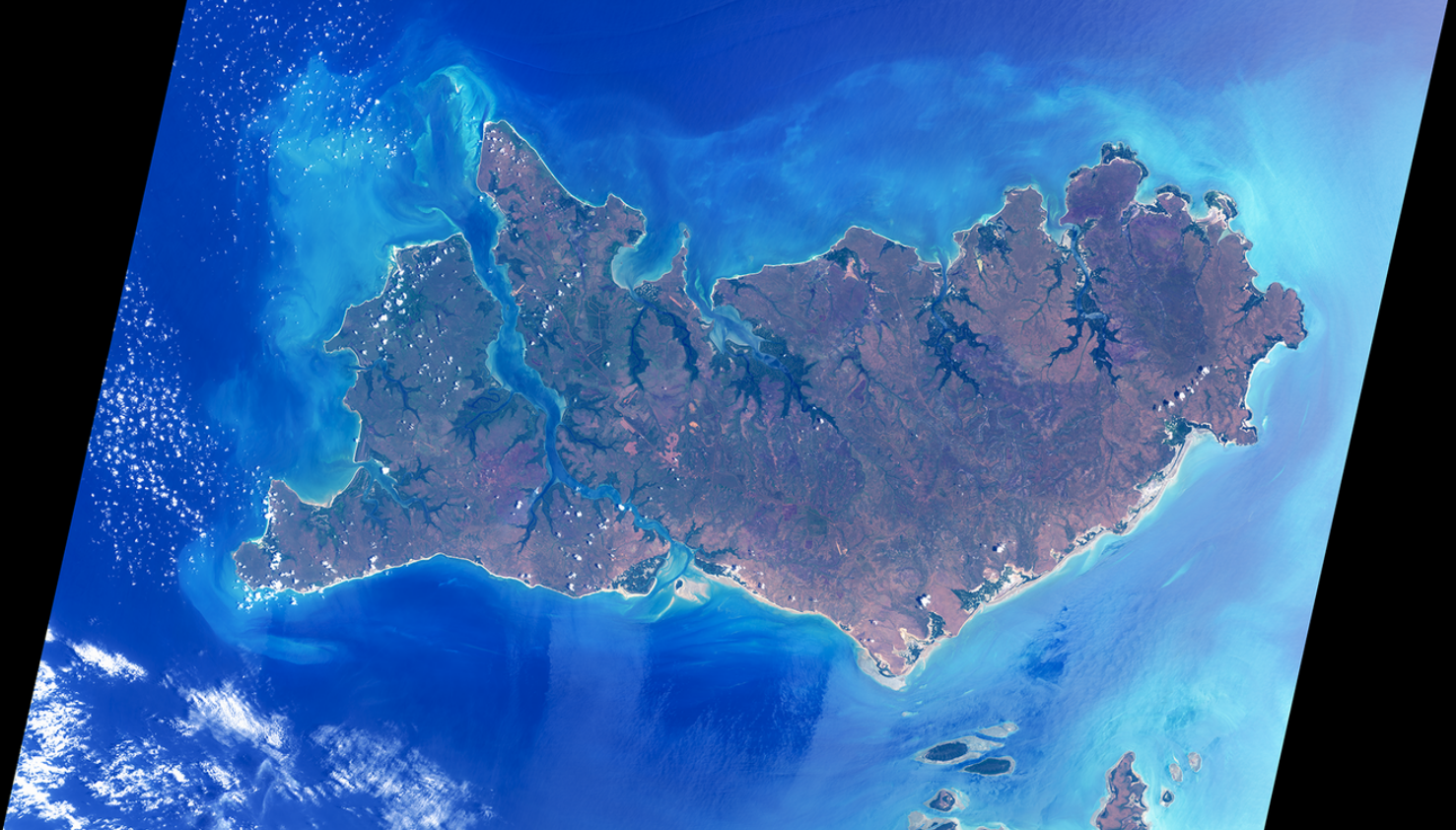
Head to the Tiwi Islands at the right time of the year and there’s a very good chance you’ll spot it at 3:00 pm in the afternoon. In a study published in the International Journal of Climatology, meteorologists looked back at satellite imagery from the early ‘90s and found that Hector could be seen on 70 percent of days during the pre-monsoon period.
They also found that the cloud had a few different moods — typically forming on schedule, but sometimes suppressed and occasionally running late — depending on the mix of atmospheric energy, wind shear, and moisture in the air. The late bloomers, interestingly, tended to pack the most punch once they finally got going.
The reason behind its regularly recurring appearance comes down to the geography of the Tiwi Islands. They consist of two relatively flat yet slightly conical islands – Melville in the east, Bathurst in the west – just north of mainland Australia.
The islands' low-lying terrain heats up rapidly under the tropical sun. As the moisture-laden sea breeze rushes over land from all angles, the converging winds meet in the center and channel upwards into a rising pillar of air. The column cools as it rises, causing the water vapor to condense into liquid water, forming the characteristically dramatic-looking cloud.
The consistent 3:00 pm timing is associated with the buildup of heat over the course of a day. Mornings start clear, giving the sun a few hours to warm up the land. As midday passes and the afternoon arrives, temperatures rise to a sweet spot that's ideal for cumulonimbus cloud formation. These conditions generally come to a head around midafternoon before fading into the evening.
Cumulonimbus clouds are a regular feature in the skies across the world. Known as the “King of Clouds”, they are the heaviest form of cloud on Earth, owing to the tank loads of water they hold. Some can weigh as much as 500,000 kilograms (1.1 million pounds) of water, while remaining effortlessly airborn.
But while cumulonimbus clouds may be a cloud-watcher's favourite, none are quite as predictable as Hector the Convector.




 1
1