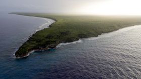


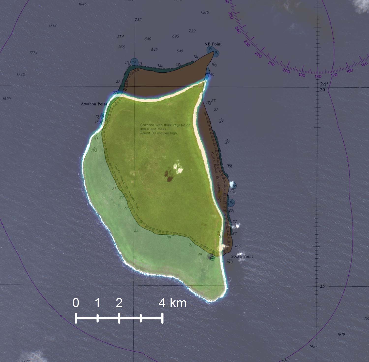
The British Royal Navy has discovered that Henderson Island, an isolated and uninhabited island in the Pacific Ocean, has been placed wrong on maps for 85 years. After arriving in the area, the HMS Spey notified officials that the island was actually a mile south of where it is marked on sea charts used by sailors since 1937.
Far out in the Pacific Ocean, Henderson Island lies 3,600 miles (5,800 kilometers) to the west of Chile and holds the upsetting title of "world’s most polluted island". With an astonishing 270 objects washing up on its shore each day, the beaches of Henderson Island are littered with man-made pollution.
The Navy uses digital charts, much like many other vessels that travel across open oceans. However, while they are incredibly accurate for often-patrolled areas, regions such as the Pitcairn Islands (which lie almost directly in the middle of the largest ocean in the world) rely on satellite data to pinpoint their exact locations.
It was highlighted that data for some of these islands may not be accurate, and the HMS Spey, which was in the area, offered to assist. HMS Spey is not a survey vessel – it is actually a River-class offshore patrol vessel – but using radar and navigational data, it cross-referenced the actual location of Henderson Island and identified the error in current maps.
“In theory, the image returned by the radar should sit exactly over the charted feature – in this case, Henderson Island,” Lieutenant Michael Royle explained in a statement.
“I found that wasn’t the case – the radar overlay was a mile away from the island, which means that the island was plotted in the incorrect position when the chart was first produced. The notes on the chart say that it was produced in 1937 from aerial photography, which implies that the aircraft which took the photos was slightly off in its navigational calculations.”
The error was identified Thursday evening, and has since been updated.
Henderson Island is relatively small at just 14.4 square miles (37.3 square kilometers) but is home to around 40 million pieces of plastic. Likely a result of incoming currents and its positioning in the middle of the Pacific, floating plastic accumulates in the area at a staggering rate. Scientists are now looking to learn more about the isolated area and humanity’s impact on it, and have collected water samples.
“Scientists in the UK have really scant data about the ocean in this region – its salinity, temperature, water pressure and the like,” Lt Royle continued.
“They are keen to understand climate change in the area.”