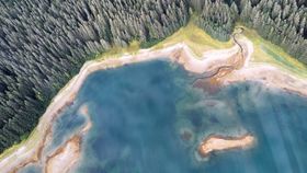
William S. Cooper was a botanist ahead of his time. In 1916, he set out north to the Territory of Alaska in an attempt to study how plants colonize newly revealed ground following a glacial retreat – research that would prove vital to studying climate change nearly a century later.
The work was meant to study how an ecosystem begins from the ground up. At the time, Cooper measured out six 1-square-meter quadrats, or plots, at the edge of a glacier in Alaska’s Glacier Bay National Park. Every five to 10 years, Cooper would visit the site and relay his findings with detailed journal entries, maps, and directions to the plots until the years just before his 1951 death. For nearly 75 years, Cooper’s plots have laid buried in soil and thick vegetation characteristic of Alaska’s bush – until now.
Brian Puma, an assistant professor of integrative biology at the University of Colorado, Denver, set out with a team of researchers in 2016 to find and expand upon Cooper’s eight forgotten plots. Equipped with archive photographs, Cooper’s described locations, and a metal detector – Cooper had marked his plots with nails or rebar on the corners with piled rock cairns nearby – the team once again headed north to characterize a diverse ecosystem.

Challenges persisted along the way. For one thing, researchers were calibrating the plot locations based on a new north. Earth’s magnetic pole had changed by 12 degrees since Cooper first began his records. Much of Cooper’s journal entries read like a treasure hunt: “Go 12 paces from the large rock, 27 degrees from north to a small cairn.” Not to mention, Alaska’s forest had grown in the three-quarters of a century since his work began, making much of the region nearly impassible and resulting in the erosion of some of the plots. In all, it took the team eight days and a combination of fieldwork, remote sensing, and dendrochronological methods to find all the plots and fill in the missing data.
“Nowhere in the world can you look through data and maps and pictures from 100 years ago and have the detail required for this type of scientific study,” said Buma in a statement.

What they would learn from their work made the difficulties worthwhile. The study of plant succession helps scientists predict how plant communities will change through time following ecological changes and disturbances like storms, winds, logging, climate change, and disease, among other things. Typically, ecologists use a strategy called chronosequence to study long periods of time by comparing old sites to young ones and filling in the gaps as to what might happen between the two. However, an old site may have looked very different from the younger site over the course of hundreds of years, which can result in assumptions.
But Cooper’s plots painted a different picture. Publishing their work in the journal Ecology, Buma and his team note that the plants spent a few decades fighting for dominance and sunlight before settling into a stable, unchanging community for more than five decades. In Glacier Bay, the quadrats stayed relatively the same; no new plants came in and existing plants reproduced asexually.
“It undermines a lot of the normal succession papers because it turns out that space really is important,” said Buma. “There are a lot of random things that happen early in the plot history – where seeds landed, for example – that still influence what we see today. It’s like standing at the edge of a cliff and kicking a rock off of the top. As it falls, the rock may bounce off one way or the other, and you could get hundreds of different paths, even though the rock started from more or less the same spot.”
The work suggests that current practices of chronosequencing may need to be reconsidered in order to accurately reflect ecosystem changes over long periods of time.