Humans
 PUBLISHED


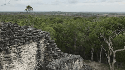


There aren't many places where you would expect to find an ancient Maya city. Anywhere outside of Mesoamerica, for instance, would be a little surprising.
But not too long ago, one student found a lost Maya city – complete with pyramids, amphitheaters, and sports fields – on around page 16 of a Google search. According to Luke Auld-Thomas, the PhD student at Tulane university who discovered it, and the team who analyzed it with him, the discovery could point to a lot more hidden cities out there waiting to be discovered.
So, how do you discover a Maya city on Google? The answer here is basically LiDAR.
In years gone by, archaeological discoveries were largely made by researchers working on the ground, seeing or uncovering signs of a structure. When lasers were invented (surprisingly recently), as well as really messing with cats' minds it provided us with the opportunity to engage in one of our favorite pastimes: measuring stuff.
"Lidar, which stands for Light Detection and Ranging, is a remote sensing method that uses light in the form of a pulsed laser to measure ranges (variable distances) to the Earth," NOAA explains. "These light pulses – combined with other data recorded by the airborne system – generate precise, three-dimensional information about the shape of the Earth and its surface characteristics."
LiDAR has been used to identify archaeological sites in the past, but its uses go beyond this, for example being used for ecological monitoring.
"The main difference between the way that ecologists use lidar and the way that archaeologists use it is that ecologists are interested in everything that's happening above ground level. For archaeologists, it's the inverse," Auld-Thomas explained to Wired.
"The first thing we do is digitally select and delete all of the vegetation to look at the ground in an archaeological context, which usually involves ruined buildings that have fallen over and become mounded through time."
In 2024, Auld-Thomas was inspired by colleagues who had looked at NASA data collected for ecological purposes and repurposed it for archaeological work. He began searching Google for other datasets that he could analyze with archaeological methods.
“I was on something like page 16 of Google search and found a laser survey done by a Mexican organisation for environmental monitoring,” he explained to the BBC.
That tucked-away search result turned out to be the jackpot. The team applied algorithms that are used to distinguish natural slopes from artificial, human-built structures, and discovered a sprawling site containing over 6,500 pre-Hispanic structures.
“Our analysis not only revealed a picture of a region that was dense with settlements, but it also revealed a lot of variability,” Auld-Thomas said in a 2024 statement.
“We didn’t just find rural areas and smaller settlements. We also found a large city with pyramids right next to the area’s only highway, near a town where people have been actively farming among the ruins for years. The government never knew about it; the scientific community never knew about it. That really puts an exclamation point behind the statement that, no, we have not found everything, and yes, there’s a lot more to be discovered.”
According to the team, parts of the city – named Valeriana – were likely constructed before 150 CE, and at its peak Valeriana was likely home to around 30-50,000 people. Much of the city appears to have been constructed between about 250 and 900 CE, with the peak coming around 750–850 CE, before the wider collapse of the Maya lowlands.
As well as being a novel way of finding an ancient and lost city, the research could help us understand how well-populated ancient Maya cities truly were.
"Because lidar allows us to map large areas very quickly, and at really high precision and levels of detail, that made us react, 'Oh wow, there are so many buildings out there we didn't know about, the population must have been huge,"" Auld-Thomas added in the statement.
“The counterargument was that lidar surveys were still too tethered to known, large sites, such as Tikal, and therefore had developed a distorted image of the Maya lowlands. What if the rest of the Maya area was far more rural and what we had mapped so far was the exception instead of the rule?"
This discovery paints a picture of a less rural civilization, inhabiting complex cities rather than isolated villages.
"Lidar is teaching us that, like many other ancient civilizations, the lowland Maya built a diverse tapestry of towns and communities over their tropical landscape,” Professor Marcello A. Canuto, supervisor of Auld-Thomas, added in the statement.
“While some areas are replete with vast agricultural patches and dense populations, others have only small communities. Nonetheless, we can now see how much the ancient Maya changed their environment to support a long-lived complex society."