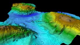
A newly detailed seafloor map shows a vast, never-before-seen underwater world teeming with mile-high seamounts that are home to a hotspot of biodiversity, reports Australia’s Commonwealth Scientific and Industrial Research Organization (CSIRO).
A chain of underwater mountains, or volcanic seamounts, was recorded 400 kilometers (250 miles) east of the island of Tasmania during a 25-day research voyage aboard the Investigator, Australia’s only blue-water research vessel. The highest of the seamounts juts 3,000 meters (almost 10,000 feet) up from the seafloor, but the tops of the peaks are still almost 2,000 meters (6,500 feet) below the ocean surface.
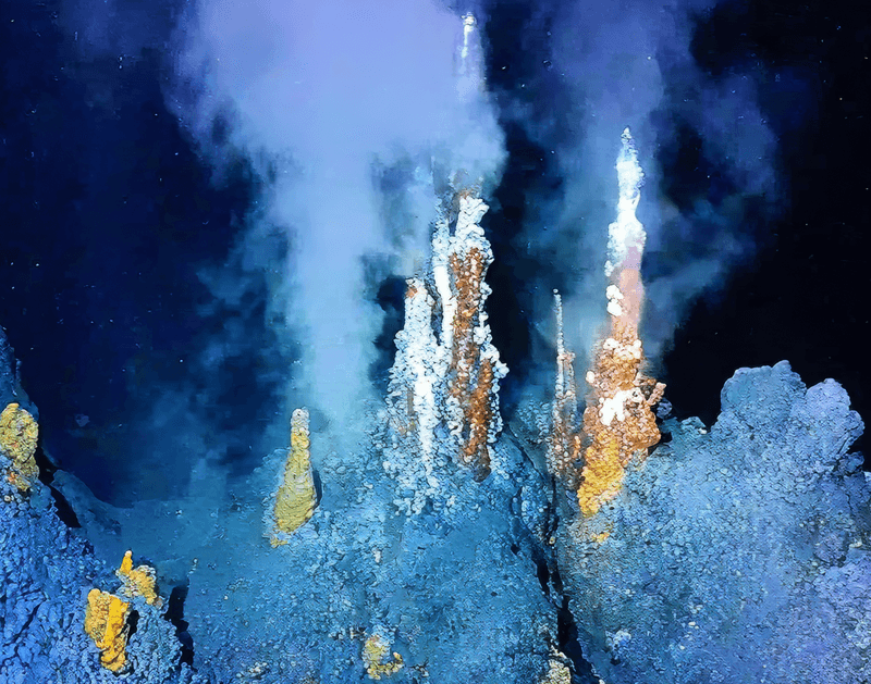
“Our multibeam mapping has revealed in vibrant detail, for the first time, a chain of volcanic seamounts rising up from an abyssal plain about 5000m deep,” said CSIRO researcher Tara Martin in a statement. "The seamounts vary in size and shape, with some having sharp peaks while others have wide flat plateaus, dotted with small conical hills that would have been formed by ancient volcanic activity.”
Data collected by the team shows spikes of ocean productivity over the seamount cluster, likely caused by phytoplankton, floating single-celled plant organisms, and the marine mammals that feed off them.
“This is a very diverse landscape and will undoubtedly be a biological hotspot that supports a dazzling array of marine life,” said Martin.
Fellow researcher Eric Woehler said he was “astounded” by the number of marine mammals and seabirds recorded over the course of their research, which included four species of albatross, four species of petrel, and dozens of whales.
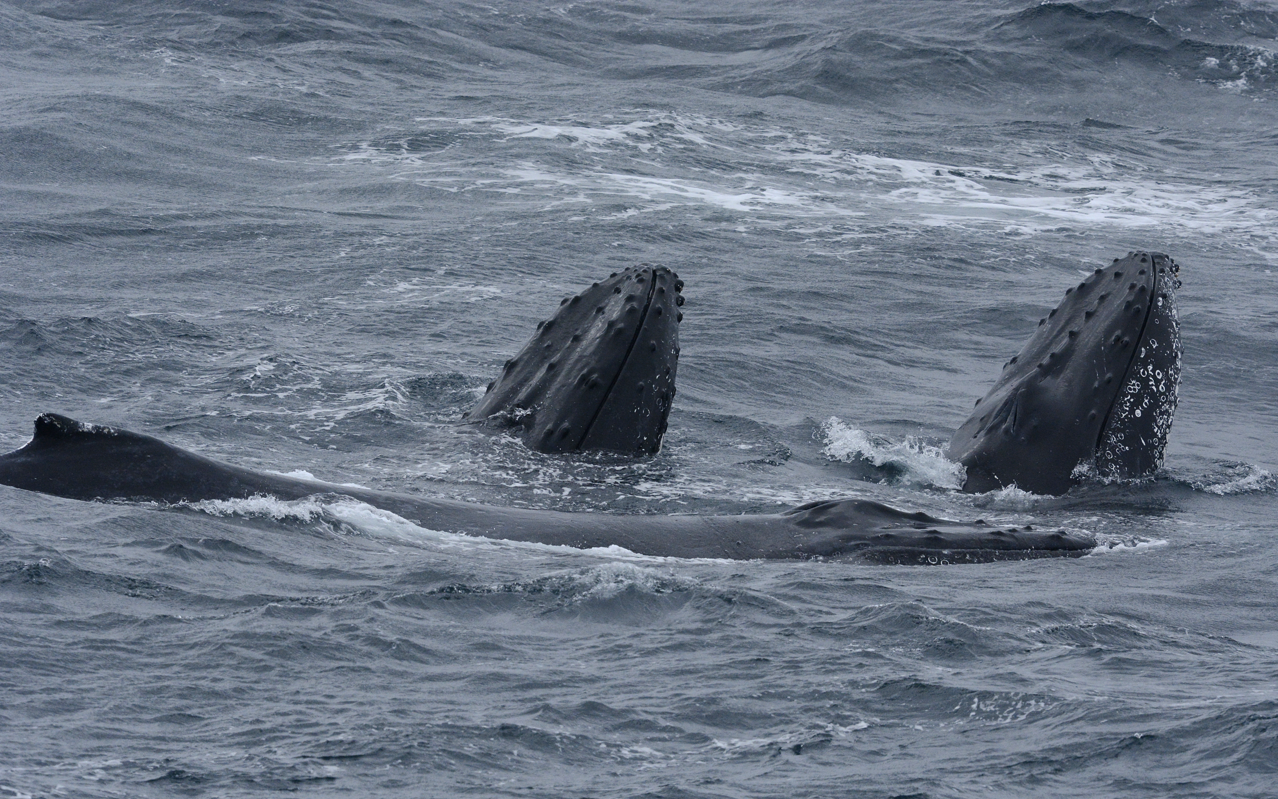
“While we were over the chain of seamounts, the ship was visited by large numbers of humpback and long-finned pilot whales,” said Eric Woehler of BirdLife Tasmania. “We estimated that at least 28 individual humpback whales visited us on one day, followed by a pod of 60-80 long-finned pilot whales the next.”
Previous research suggests whales and other migratory underwater animals may use seamounts for navigational purposes, and mapping such a potentially diverse area could help to protect and manage the region for endangered animals, as well as provide a foundation for future research.
CSIRO is Australia’s national science agency. Operating the Investigator year-round, the agency plans to return later this year for two more expeditions dedicated to collecting rock samples and capturing the underwater landscape with high-resolution cameras.