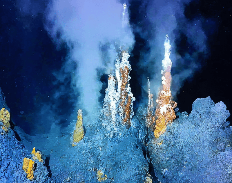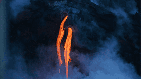
Underwater volcanic eruptions are barely seen, but their aftermaths tell the tale of some truly spectacular fireworks. Back in 2012, for example, a submerged fiery fountain emitted the equivalent of seven Manhattan’s-worth of volcanic debris in less than a day, which was first spotted not in person, but from space.
Now, as highlighted by a brand-new study by the Commonwealth Scientific and Industrial Research Organisation (CSIRO), along with the Universities of Aberdeen and Adelaide – two institutions a geographical world apart – underwater lava flows, when mapped, can look extremely surreal too.
Although the paper itself isn’t brave enough to make the comparison, the team’s press release suggests that this submerged hellscape looks a lot like “Mordor-under-the-sea,” which sounds like a much-needed mashup of Lord of the Rings and The Little Mermaid. To be fair, though, the maps you’ll find in Lord of the Rings do look a lot like these new works of volcanic cartography.
In order to make these rather aesthetically pleasing maps, the international team of geophysicists beamed seismic signals from a boat down to the seafloor. Seismic waves reflect and travel through objects differently depending on what they’re made of, and using this information, complex, 3D pictures of otherwise obscured landscapes can be created.
In a way, it’s like creating a painting using seismic waves.
So what have CSIRO and co. actually mapped? Well, they were sailing over the Bight Basin Igneous Complex (BBIC), a 120-kilometer (81-mile) long site of volcanism off the coast of southern Australia dating back to the middle of the Eocene epoch, between 56 and 34 million years ago.
The team found 26 buried lava flows, associated with volcanoes both tall and small. They range in length from 0.5 kilometers (0.31 miles) to a whopping 34 kilometers (21 miles), and their structure appears to suggest that they were erupted offshore in water depths of around 300 meters (984 feet).

As reported in the journal Geochemistry, Geophysics, Geosystems, all of these frozen flows exhibit a range of curious features. Their anastomosing nature has surrounded older bits of the now-buried seafloor, creating islands of land gloriously named “kipukas”.
All in all, it’s created a mountainous, otherworldly environment, full of shield volcanoes and hydrothermal vents, now subsumed beneath the waves and sand.
Wait – Australia, a land not exactly famed for its volcanism, used to feature some pretty substantial eruptions? That’s right, dear readers.
In fact, it used to be incredibly volcanic: 106 million years ago, as Australia rifted away from Antarctica during the breakup of the supercontinent Gondwana, eruptions could be so powerful that debris was propelled 2,300 kilometers (1,430 miles) away from the source vent.
Lest we forget that some volcanoes in Australia are surprisingly young, with tales of their eruption passed down by Aboriginals for 7,000 years or so.
Australia’s southern margin was notoriously volcanic, and the BBIC was a product of this. There have been plenty of explanations proposed as to why this was the case, ranging from unusual crustal behavior to an upwelling plume of mantle material known as the Cosgrove hotspot.
In any case, submarine volcanism is, generally speaking, poorly understood. This type of pioneering research will help improve our understanding of how it works, where all its energy goes, and what kinds of underwater architecture it’s capable of producing.

The team’s study concludes by noting that their work “highlights the usefulness of seismic data as a tool for exploring ancient volcanic provinces.” As has been made clear, it’s also rather good at producing maps worthy of Tolkien.