

It’s not easy to peer under ice, whether that be shelves floating on coastlines or the thick, ancient material locked – for now – to the hidden continental rock underneath. Fortunately, thanks to plenty of radar research and, on occasion, an extremely long drill, scientists are increasingly discovering worlds of bizarre crystals, canyons, and microbe-rich lakes.
As spotted by BBC News, the latest chapter comes courtesy of a new Geophysical Research Letters study. Led by Northumbria and Newcastle Universities, the work details the new discovery of canyons and mountain ranges buried by hundreds of meters of ice.
Three troughs – named the Patuxent Trough, the Offset Rift Basin, and the Foundation Trough – are unfathomably colossal, with the most expansive, Foundation, being at least 350 kilometers (218 miles) long, about the distance between New York City and Boston. It’s also 35 kilometers (21.8 miles) wide, which roughly means it’d take the average person 7 hours to walk from one side to the other.
“The troughs are presumably tectonic in origin, but we attribute their size and geometry to historic glacial erosion during the Oligocene and Miocene, when the ice sheet was thinner,” lead author Dr Kate Winter of Northumbria University, told IFLScience
This magnificent discovery represents the very first entry into the fray from the PolarGAP Project. Spearheaded by the British Antarctic Survey (BAS), it’s literally designed to fill in an informational gap near the South Pole.
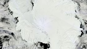
What lies beneath the gap in satellite gravity data coverage? That's what PolarGAP was designed to uncover. BAS
Two of the European Space Agency’s Earth-observing satellites – the ice-thickness-ascertaining CryoSat 2 and the Gravity field and steady-state Ocean Circulation Explorer (GOCE) – weren’t able to observe a high-latitude segment of Antarctica. Planes equipped with a variety of instrumentation, including that old classic, ground-penetrating radar, were enlisted to complete the picture.
That they have. Described by the BAS as “the first modern aero-geophysical survey of the South Pole region,” it’s far more than just marveling over what’s hidden down below the ice. As all research relating to the cryosphere is inextricably linked, the team here are curious about how climate change will affect the region.

Antarctica is frankly massive, and incredibly varied. Parts of it, including the Antarctic Peninsula and large swaths of West Antarctica, have experienced significant warming in the 20th century, as opposed to other parts that have remained thermally stable in this regard.
These temperature differentials, along with the unique hydrodynamic and geological properties of each region, mean that Antarctica’s sea and land ice is not reacting uniformly to the increasingly warm world. Ultimately, there’s much that remains to be understood about the future of this complex continent.
One of the more enigmatic regions is the so-called “bottleneck” zone where the ginormous West and East Antarctic Ice Sheets meet. Clearly, these icy behemoths interact, and the team’s new study notes that any collapse in the West could change how the East behaves.
In order to confirm or reject any hypotheses relating to this dynamic system, though, we need to see what it’s all sitting on, which is where these satellites and PolarGAP come into play.
The newly identified troughs likely promote enhanced ice flow through Antarctica’s heart in a warming climate. This could increase the mass discharge from the interior of West Antarctica into the Southern Ocean, and thereby trigger additional sea level rise.
At the same time, it seems that the mountain ranges may form a rather useful blockage. Should the West Antarctic Ice Sheet begin to collapse, then ice can’t drain in as easily from the East as previously thought.
“The overall message is quite positive,” Winter added. Along with this mountain-clogged bottleneck, the “undisturbed layers in the center of the West Antarctic Ice Sheet suggest that the ice divide has been stable for several millennia, and there is no indication that this will change anytime soon.”
“As the East Antarctic Ice Sheet is much larger than the West Antarctic Ice Sheet, this lessens the fear that East Antarctic ice could raise global sea level in our lifetime.”
Before anything’s set in stone, though, more data is required, and this new data will be used to improve computer model simulations of the future of the Southern Continent.