It’s perhaps easy to forget the power of methane as a greenhouse gas when it's colorless, unable to be held like an apple or flipped through like a book. However, the impact of methane is a real and present problem.
To examine the distribution of the gas in California, a team of NASA scientists flew a plane over the state for three years to map particularly potent sources. Now, they’ve reported their findings in the journal Nature, noting that less than 10 percent of point sources – dubbed super-emitters – are responsible for more than half of California’s total emissions surveyed.
Digging deeper, NASA notes that less than 0.2 percent of infrastructure elements in the state are responsible for between 34 and 46 percent of the total methane inventory, based on a survey of 272,000 facilities and components. That figure includes all emission modes: point sources (included in the new study) and area sources (not included in the study).
The source of these emissions includes landfills (41 percent), dairy farms (26 percent), and natural gas facilities (26 percent). Of the 270 solid waste disposal sites surveyed, 30 were found to emit large anomalous plumes, making up 40 percent of the total point source emissions. Of the 166 composting facilities, methane plumes were detected at two facilities.
It’s important to note that this study was designed to detect high concentrations of methane from a single source. Therefore, small natural gas leaks from homes were below detection levels, even though collectively they may impact atmospheric levels. They also note that many of the sources have not been verified by ground sources. The report doesn’t specify further who these "super-emitters" are but they do provide a publicly available map and data from the study.
"Many of these methane super-emitters appear to be highly intermittent and due to random malfunctions or leaks spanning the energy, waste and agriculture sectors," noted the Jet Propulsion Laboratory on their site.
"In several test cases we shared our data with facility operators who used it to guide confirmation and repair efforts."

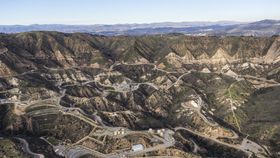
The team’s remote-sensing approach allowed them to assess large spaces quickly and at high spacial resolution. In doing so, they identified 564 strong methane sources. They found that nearly 70 percent of the oil and gas point source emissions were linked to oil production in the southern San Joaquin Valley. Most of this includes leaks at compressor stations and some distribution pipelines, and not the tiny leaks from downstream natural gas infrastructure since those were below the detection threshold of this study.
The researchers say understanding where methane leaks are occurring will help people better control and monitor these sources. The data can also be used by state and local agencies to inform decisions on methane-emission mitigation.
"These findings illustrate the importance of monitoring point sources across multiple sectors [of the economy] and broad regions, both for improved understanding of methane budgets and to support emission mitigation efforts," said lead scientist Riley Duren, who conducted the work for NASA's Jet Propulsion Laboratory, in a statement.
The study was a joint effort between NASA, the California Air Resources Board (CARB), and the California Energy Commission.