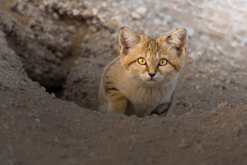


It’s safe to say that the explosive volcanic eruption at Guatemala’s Volcan de Fuego (“volcano of fire”) caught the local population by surprise. Although a second explosive event was briefly cause for concern, it was Sunday’s fire and fury that robbed at least 109 people of their lives, with hundreds more missing and feared dead.
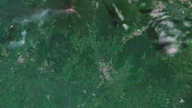
The rest of this article is behind a paywall. Please sign in or subscribe to access the full content.As is increasingly the case, satellite imagery is being used to help humanitarian workers, volcanologists, and other authorities grasp the scale of the disaster. Although enlightening, data freely released by satellite company Digital Globe is proving to be especially devastating: comparing pre- and post-eruption images emphasizes just how powerful and deadly pyroclastic flows can be.
The humanitarian effort there is in full swing, but the search for the missing has been suspended. It’s rather unlikely that anyone else will be found. Entire towns and villages were buried, scorched, and obliterated all at the same time in mere moments, as those clouds of fire charged down the valleys in Fuego’s shadow.
Pyroclastic flows are a type of pyroclastic density current, mixtures of hot ash, lava, gas, and entrained debris that emerge from explosive volcanic activity. In the case of the Fuego eruption on Sunday, it appears that there were a combination of formation mechanisms based on the video footage.
The most obvious was that the explosion generated a sustained column of ash above the vent, launching fresh volcaniclastic products through the sky and into the stratosphere. This spread out over a distance of at least 97 kilometers (60 miles), before raining down on the landscape.
When parts of this column lost upward momentum, however, it fell down to Earth, creating a pyroclastic flow. It’s also possible that some of the less buoyant parts of the eruption column simply “boiled over” at the vent, and rushed straight down the slopes.

Details remain fuzzy, but as these images clearly show, the effects were horrific, particularly as there was little warning of what was about to transpire. People, cars, buildings, and anything standing in the path of these flows, moving at speeds of around 80 kilometers (50 miles) per hour, were blasted away.
Anyone caught up in the flows would have experienced internal temperatures ranging from 200 to 700°C (390-1,300°F). Much like the victims of Pompeii, they would have experienced extremely severe burns, extreme heat shock and organ failure within mere moments, and perished.
As these satellite images show, entire villages are now nothing but muddy cinders. At the same time, the danger isn’t over. Another explosive event at Fuego could cause similar flows, but plenty of volcanologists are keen to point out that that’s not the only danger here.
When the material from a pyroclastic flow settles, it’s mostly in the form of an unconsolidated sheet of ash. It’s rainy season there right now, so inundation of this ash is likely. When wet enough, and when on a slope – say, in a valley – it can quickly mobilize as a mudflow. Named “lahars”, these are fast-moving, concrete-like mudslides, and they also take people by surprise.
Sure, pyroclastic flows can be deadly: they’ve killed 45,000 people in the 20th century alone, which accounts for about 49 percent of all volcanic deaths.
Lahars shouldn’t be underestimated though. The most horrific example comes courtesy of Colombia’s 1985 Nevado del Ruiz disaster, when pyroclastic flows were mobilized by melting glacial water. The resulting colossal mudflows killed as many as 23,000 people while they slept in their beds.
These satellite images, then, will help volcanologists work out which areas are most at risk. Good luck to all involved.