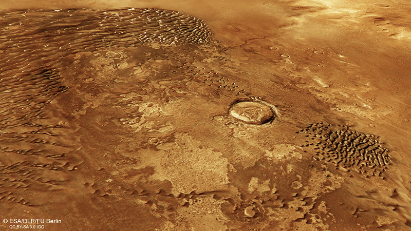


A new stunning image from NASA’s Mars Reconnaissance Orbiter (MRO) gives us a great and amusing view of the effects of water back when Mars was still a warm and wet world, over 3.5 billion years ago.
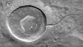
The subject of the MRO is an impact crater with a thin long tale, which has caused people to describe it as resembling a sperm or – as a more family-friendly version – a tadpole. The crater was formed by a meteorite impact and is between 150 and 200 meters (490-660 feet) across. The tail was created later on, when the water that filled the crater breached the rim and flowed downhill.
“When studying these images in detail, scientists can gain a better understanding of the strength of the flooding water that carved the channels, and better understand the history of water activity in this region of Mars," NASA stated in a press release. “It is often difficult to differentiate between inlet and outlet channels, but water always flows downhill. In this particular case, we can infer that water is flowing outward because we have the necessary terrain-height information.”
The image here is on a scale of 25 centimeters (9.8 inches) per pixel and the way it is compressed guarantees that any feature larger than 99 centimeters (38.9 inches) is resolved. The map is orientated, which means that North is up. The image was snapped by the High-Resolution Imaging Science Experiment (HiRISE) camera onboard the craft.
MRO is a multipurpose spacecraft with a wide array of instruments. It has several cameras that have been used to map the surface of Mars, a radar to see a bit below the surface, a spectrometer to study minerals, and the Mars Climate Sounder that studies variation in the thin atmosphere of the Red Planet.
The abundant data from the mission has helped uncover the unknown, like a large deposit of ice as big as Lake Superior. And the thousands of images have provided some unique views of Mars. Currently, citizen scientists are at work looking for interesting details on the surface. Volunteers can sign up to the project, called "Planet Four: Terrains”, and highlight peculiar features on images from the standard camera on MRO. The project is part of the Zooniverse citizen science portal and the interesting targets will be followed up using HiRISE.