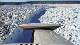


Glaciers usually move, well, glacially. However, Greenland's Sermeq Kujalleq (also known as Jakobshavn Isbræ) travels at a more rapid rate, making it the huge island's fastest moving river of ice. It seems this high-speed flow is partially the consequence of a real river, one that in warmer times carved out the valley through which Jakobshavn Isbrae now flows.
The rest of this article is behind a paywall. Please sign in or subscribe to access the full content.Some radio frequencies pass through ice with ease, and NASA has been using this fact to survey the bedrock beneath Greenland. In studying the revealed shapes Michael Cooper, a PhD student at the University of Bristol, concluded a vast basin drains 20 percent of Greenland's area.
The discovery follows the “mega-canyon” discovered in Greenland's north in 2013.
“Subglacial topography exerts strong controls on glacier dynamics, influencing the orientation and velocity of ice flow,” notes Cooper and colleagues in a paper published in Geophysical Research Letters.

The basin drained by Sermeq Kujalleq covers most of southern Greenland. Cooper et al Geophysical Research Letters
"The drainage basin we discovered shows signs of being carved by ancient rivers, prior to the extensive glaciation of Greenland (i.e. before the Greenland Ice Sheet existed), rather than being carved by the movement of ice itself,” Cooper said in a statement. “It has been remarkably well preserved – and has not been eroded away by successive glaciations. The channel network has never been seen before by humans – it was last uncovered around 3.8 million years ago."
The limited effect the glacier has had on the preexisting basin is attributed by the authors to circumstances where surface meltwater reaches the glacier's bed or where higher temperatures allow increased ice velocity.
The area drained by this single network is 450,000 square kilometers, (175,000 square miles), an area equivalent to the Ohio River drainage basin, more than twice the size of Great Britain. Were they not buried under mountains of ice, canyons 1,400 meters (4,590 feet) deep and 12 kilometers (7.5 miles) wide would be famous tourist attractions.
As it is, the basin's importance lies in the contribution it makes to Sermeq Kujalleq's flow. “It is remarkable to consider that the ancient bed topography has such a marked influence on the location of surface velocities and ice dynamics,” the paper comments. In 2012 the already fast-moving glacier accelerated to unprecedented speeds of 17 kilometers (11 miles) a year. Three years later this led to a massive calving event.
“Surface velocity increases by many orders of magnitude towards the outlet,” the paper reports. This is driven in part by increased ice thickness and the convergence of many streams, but the authors add, “it is remarkable to consider that the ancient bed topography has such a marked influence on the location of surface velocities and ice dynamics, where the flow of ice itself is usually seen as an important control upon bedrock topography from an erosional standpoint.”
This rapid flow has meant that the Sermeq Kujalleq accounts for a very large proportion of the loss of ice mass from Greenland, making it a major contributor to rising sea levels.