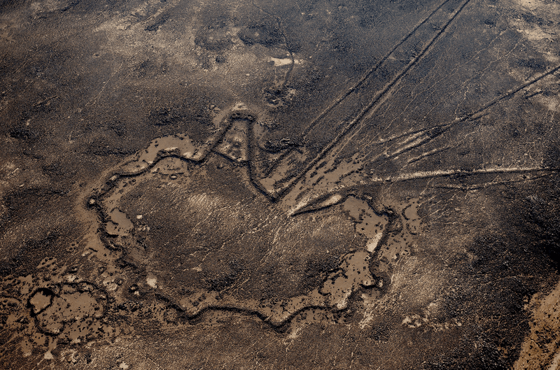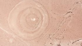


Half a millennia ago, the Qhapac Nan road system once stretched from modern-day Ecuador to Chile. Built for foot traffic during the Inca Empire, the road featured cobblestone paving, bedrock steps, rope suspension bridges, and more than 90 circular geoglyphs. Now, a team of researchers believes they’ve figured out the glyphs’ very practical use: road signs.
The rest of this article is behind a paywall. Please sign in or subscribe to access the full content.The pre-Columbian circular geoglyphs were made using a technique called “campo barrido” by removing surface stones and the top layer of soil to expose the lighter-colored earth below. Ranging from 3 to 55 meters (10-180 feet) in diameter, the structures are shaped in a variety of animalistic representations, including a winged-human figure that researchers nicknamed “Batman”. Just as interesting as the designs themselves are their proximity to the ancient road, leading researchers to perform a spatial analysis that used mapping systems, drones, and high-resolution satellite imagery to determine the relationship between geoglyphs and the road system. Pieces of fragmented pottery found in the geoglyphs and other nearby features suggest the geoglyphs and trail are pre-Columbian.

The researchers found that the pathway and the circular geoglyphs were closely connected, which they suggest were made by travelers participating in rituals for local deities to ensure a successful journey or as markers along the way for future travelers.
"People tend to want to think that geoglyphs were doing one thing for thousands of years. Our work in Sihuas suggests that people did geoglyphs for different reasons in different time periods," study author Justin Jennings told IFLScience. Writing in Antiquity, the team says these geoglyphs could be similar to piles of “apachetas” – stones left by travelers throughout the Andes (and now the modern world) that marked trails and directions for people.
“Contemporary herders and travelers propitiate a wide variety of natural and anthropogenic features on their journeys, taking a moment to rest and make an offering of a cobble, cigarette, alcohol, piece of cloth, coca or other items,” wrote the others.
High concentrations of “rock cairns, wind blocks, painted stone cobbles, and ceramic scatters” found during the research survey indicate many people spent time on these paths, particularly as they linked together long-standing settlements.
Next, the researchers hope to conduct a more in-depth analysis to further date the sites and to incorporate other geoglyph shapes to determine if they may also have meaning or associations linked to travelers.