Rocks that look like they will roll down and crush you at the slightest provocation are more than just great backdrops for selfies. They can help assess an area's earthquake risk and whether it's safe to build there. The good news is that a part of California where this technique was first applied is safer than previously thought, which is reassuring because there's already a nuclear power station located there.
In many places around the world, one can find large boulders poised upon the Earth below, usually after softer surrounding material has eroded away. Others are left behind by glaciers that retreated as the world warmed.
Either way, these objects, creatively known to geologists as precariously balanced rocks (PBRs), can be displaced by sufficiently energetic earthquakes. Therefore, Imperial College London PhD student Anna Rood reasoned, their survival indicates any nearby earthquakes since a PBR's origin must have been smaller than the minimum-sized quake to displace it.
That in turn offers a way to solve, or at least improve, one of seismology's core problems – how to tell how prone a site is to large earthquakes and therefore how safe it is to build there. Although efforts have been made to assess earthquake danger based on measurements of a fault's physical characteristics, these have not yet proven reliable.
Instead, the usual way is to use data on previous disturbances. Past performance may be no guarantee of future results, as the ads say, but it's often the best guide we have. Unfortunately, however, our records of earthquake strength are uncomfortably short term, particularly in places where written records are recent. Consequently, seismologists have trawled landscapes for signs of big movements.
Rood has turned this around, finding evidence for the absence of large earthquakes in an area of California sandwiched between the Hosgri and Los Osos Fault Zones, offshoots of the San Andreas Fault.

“PBRs act like inverse seismometers by capturing regional seismic history that we weren’t around to see, and tell us the upper limit of past earthquake shakes simply by not toppling,” Rood said in a statement.
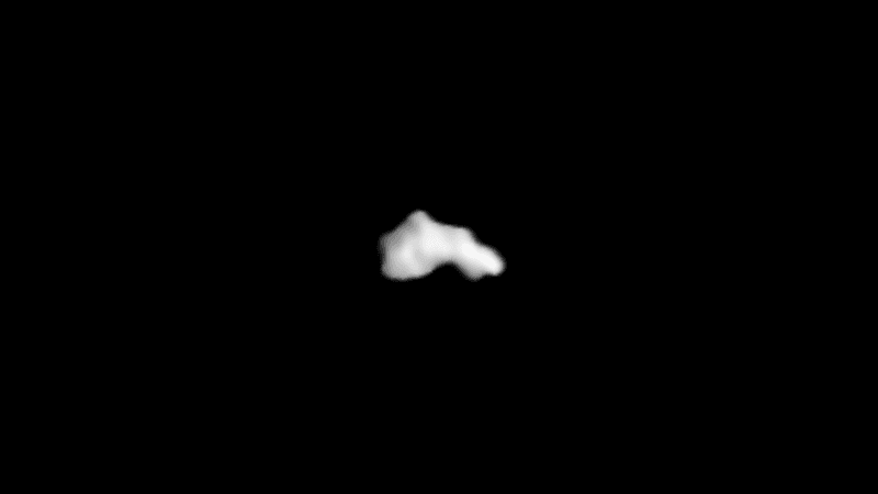
Rood identified seven PBRs located at the appropriately named Double Rock, California, and modeled the forces required to roll them off their perches. Then she used ratios of beryllium in the PBR's surface layers to calculate how long the boulders have been exposed to cosmic rays, indicating when they lost the casing of softer material that would once have stopped them moving.
In AGU Advances, Rood and co-authors use this information to determine that earthquakes that occur every 1 in 10,000 years or so in the area are 27 percent smaller than previously estimated. Moreover, the uncertainty in this figure has been reduced by 49 percent.
That doesn't eliminate the chance of an earthquake large enough to unseat the boulders and do some major damage to nearby towns before 2020 is out, but it does mean the chances are even smaller than previously thought. That's useful information for insurance companies and engineers who might otherwise overbuild. It's also a relief to anyone worried about the location of the Diablo Canyon Nuclear Power Plant, which sits just up the coast from Double Rock.