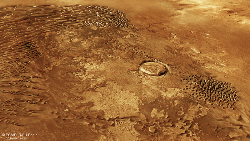


Is this an entrance to a Sarlacc pit? Most likely not. Nevertheless, this image of the Martian surface reveals some fascinating things about the geology and topography of Mars.
The newly released image was taken by the HiRISE camera onboard NASA's Mars Reconnaissance Orbiter above the southern hemisphere of Mars. This region of Mars is an icy terrain, caked in carbon dioxide ice that's marked with these pits and craters, known as Swiss cheese features, that can be over 100 meters (330 feet) wide.
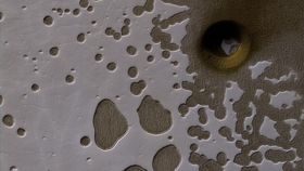
The image was captured during Mars’ late summer, when the Sun is low in the sky and there is good lighting to capture images of this kind of topography. The defining feature of the image – the gaping hole near the top right – is causing scientists at NASA to scratch their heads.
“We see many shallow pits in the bright residual cap of carbon dioxide ice (also called "Swiss cheese terrain"). There is also a deeper, circular formation that penetrates through the ice and dust,” NASA explain. “This might be an impact crater or it could be a collapse pit.”