

The surface of Mars is cracked by an enormous rift valley, Valles Marineris, the largest known system of canyons in the Solar System. On Earth, it would span from the northernmost tip of Norway to the southern tip of Sicily, or almost from one coast of the US to the other. New images have revealed some spectacular views of the inside.
This incredible geological feature continues to reveal more and more to the orbiters we have placed around the Red Planet. Now, the European Space Agency (ESA) has released images taken by its Mars Express High Resolution Stereo Camera (HRSC), which allowed not only new detailed observations of this great canyon but a 3D reconstruction.

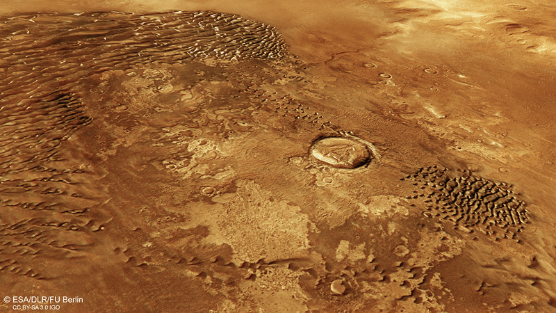
The new images focused on two major trenches (or chasma) that form part of western Valles Marineris. The southern one is the 840-kilometers-long (520 miles) Ius Chasma, and north of it is the 805-kilometer (500 miles) Tithonium Chasma.
.jpg "The crags and cliffs of the Valles Marineris on Mars")
The images are stunning but the fantastic detail comes from the ability of HRSC to deliver elevation maps. These trenches are 7 kilometers (4.3 miles) deep and 3D reconstructions show incredible new details of these extremely deep scars on the surface of Mars.
The views show dark sand dunes, mountains that can rival the Alps in height, as well as mounds of sulfate minerals. One hotly debated theory suggests that these formed when the chasms were filled with water, eons ago. Tectonic features and the effects of billions of years of erosion have crafted an incredible environment in this enormous valley.
If you want a really trippy view, dig out your 3D red-green or red-blue glasses and check out this stereoscopic image of both the Ius and Tithonium Chasmata.

Mars Express has been orbiting the Red Planet since 2003, mapping and imaging its surface, probing beneath its crust, and even identifying the composition of its thin atmosphere. There's a lot it can see and do and reveal without ever touching down on the surface.