NASA’s Lunar Reconnaissance Orbiter (LRO) was launched in the summer of 2009. Over the next four years, it took over 10,500 high-resolution images of the Lunar North Pole. Though it isn’t the first time that region has been imaged, it is the first time it has been done at such a high resolution. In 2011, LROC released a different image of the same area of the moon, with each pixel covering 100 meters. This newly-released image has 50x the resolution!
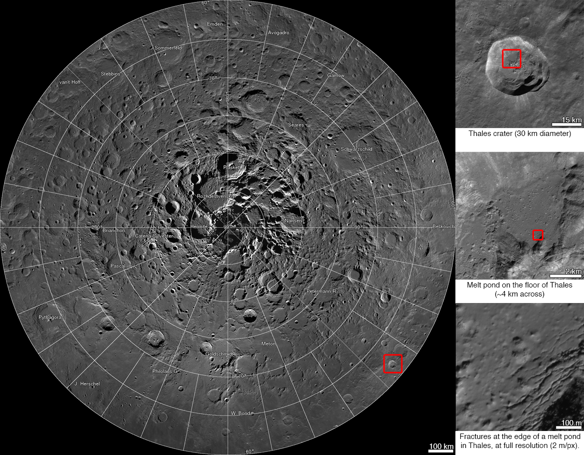
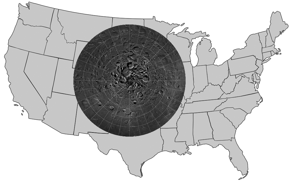
The images were assembled into one of the largest mosaics available on the internet. How large is it? Each pixel covers 2 meters of the lunar surface. With a total of 681 billion pixels, the portion of moon that has been mapped would cover about a quarter of the United States:
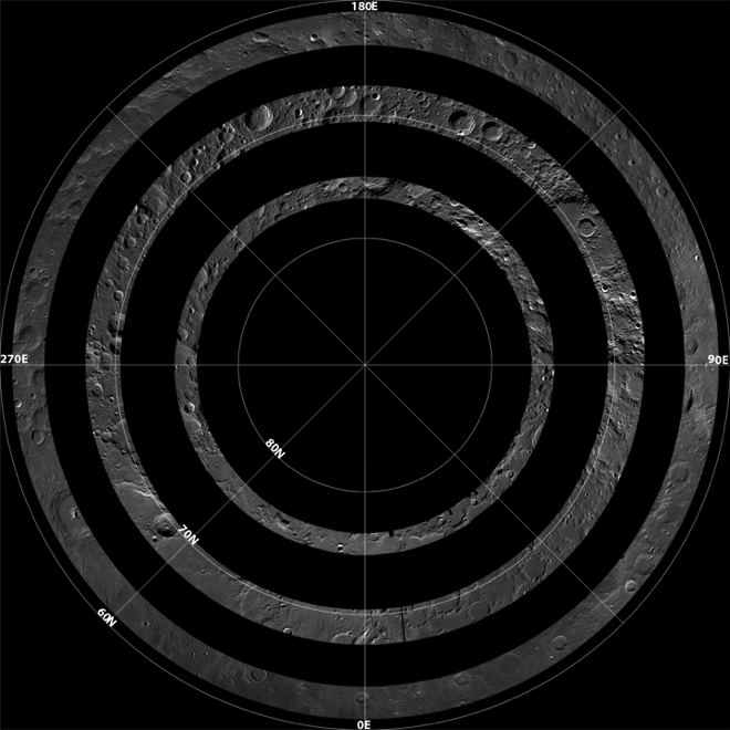
The images collected by making “collar mosaics” by imaging the same latitude every two hours for a month. The moon’s rotation brought new light to some of these areas and allowed the clearest images to be used. Each collar spans 1-3 degrees of latitude and altogether, the mosaics cover from the North Pole (90˚N) all the way down to 60˚N.
The information obtained from these images will help NASA’s scientists plan future missions. They will be able to determine potential landing sites and areas of interest for further study.
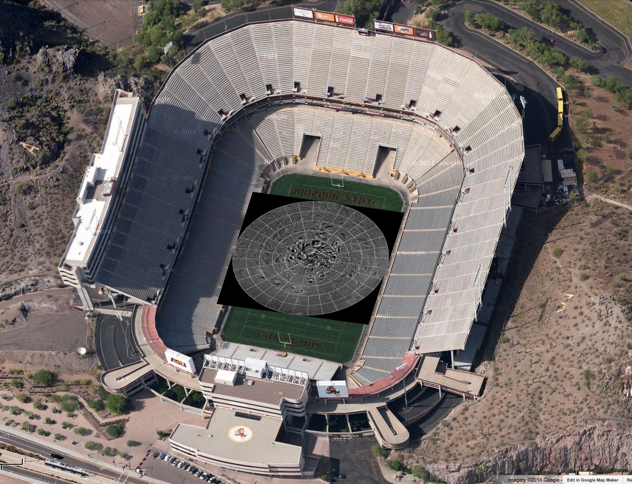
If the mosaic were printed out at 300 dpi, the resulting picture would cover an entire football field!
Downloading the entire mosaic—even as a compressed JPEG file—would take nearly a terabyte of space on your hard drive, so it’s probably just easier to view it online in its interactive format.
All images credited to: NASA/GSFC/Arizona State University