


Geologists working in southwestern Utah have discovered the remnants of a catastrophic landslide—one of the two largest known on land—that took place within minutes around 22 million years ago. Called the Markagunt gravity slide, it extended over an area larger than 3,400 square kilometers. That’s about the size of Rhode Island, three counties in Ohio, or 39 Manhattans.
Smaller portions of the Markagunt landslide have previously been identified, but its enormous extent wasn’t revealed until these new mapping efforts. According to a trio of researchers led by David Hacker from Kent State, the 90-kilometer-long slide mass had a volume of up to 2,000 cubic kilometers: It was as fast as it was massive. Parts of it were 200 meters thick. The findings were published in Geology this week.
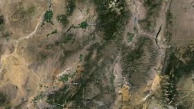
The landslide took place in an area between what’s now Bryce Canyon National Park and the town of Beaver, Utah, though you can’t see much of the slide today. “Looking at it, you wouldn’t even recognize it as a landslide,” Hacker says in a news release.
But internal features—which were exposed in outcrops—showed evidence of a landslide in the form of jigsaw puzzle rock fractures, shear zones, and pseudotachylytes. The latter are rocks that melted into glass because of immense friction, and their presence suggests that the slide occurred within minutes. Anything living in its path would have been wiped out.
 Pictured to the right, Hacker points to pseudotachylyte layers and veins within the Markagunt gravity slide. Material from the landslide—shattered rocks, lava flow, volcanic mudflow, sandstones, and ash tuffs—were sandwiched between well-studied layers of volcanic ash, which allowed the researchers to date the catastrophe.
The slide originated when the Marysvale volcanic field—consisting of many strato-volcanoes similar to Mount St. Helens, which erupted in 1980—collapsed, giving way to the massive landslide. The collapse may have been caused by the vertical inflation of deeper magma chambers, which fed the volcanoes. Molten rock rising toward the surface could have pushed the flanks of the volcanoes upward and sideways, fracturing rocks and creating unstable piles of material ripe for a landslide, study co-author Robert Biek of Utah Geological Survey tells Science.
Only one other continental landslide rivals Markagunt in size (larger slides do exist on ocean floors). The Heart Mountain slide, which was discovered in the 1940s, took place around 50 million years ago in northwestern Wyoming. Once it's mapped in greater detail, Markagunt could prove to be much larger than the Heart Mountain slide.
Mega landslides like these help researchers understand extreme, hazardous events. Not to mention, both the Markagunt and the Heart Mountain slides helped document, for the first time, how large portions of ancient volcanic fields have collapsed; they show the magnitude of what could happen in modern volcanic fields like the Cascade Mountains, home to Mount St. Helens.
The team will continue to map the slide, collect samples from the base for structural analysis, and date the pseudotachylytes.
Images: Google Earth via American Geophysical Union blog (top), Kent State University (middle)


