
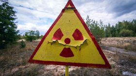


More than three decades on from the largest nuclear accident in history, radiation levels in parts of the 2,600-square-kilometer (1,000-square-mile) exclusion zone around Chernobyl remain dangerously high. In an effort to map the fluctuations in radioactivity across the region, researchers have used drones to survey the contaminated landscape, revealing deadly hotspots of intense radiation that the authorities had no idea existed.
When the Chernobyl nuclear power plant’s reactor number four exploded in April 1986, it released more than 400 times more radiation than the atomic bomb dropped on Hiroshima at the end of World War II. Over the years, radioactivity levels have gradually decreased, and in 2011 parts of the exclusion zone were opened to tourists. However, with more than 70,000 visitors a year to Chernobyl, Ukraine, it’s pretty important that those in charge know about any face-melting radioactive hotspots.
A team from the UK’s National Centre for Nuclear Robotics developed a drone mapping system that they used to create a detailed picture of a 15-square-kilometer (5.8-square-mile) section of the exclusion zone. To do so, they first sent out a fixed-wing drone on 50 separate flights over a 10-day period to scan the area in a grid pattern.
The drone used a remote laser-sensing method called Light Detection and Ranging (LiDAR) to create a three-dimensional map of the terrain, and a gamma-ray spectrometer to measure radiation levels. Any interesting or unusual spots were then investigated in greater detail using a rotary-wing drone, which is able to hover extremely close to locations that would be far too dangerous for humans to enter.
Starting around 13 kilometers (8 miles) from the site of the old reactor, the drones gradually moved towards the Red Forest – so called because the disaster caused the leaves on all the trees to turn red. Sitting just just 500 meters (0.3 miles) from the site of the explosion, the forest was always likely to be full of radiation, but the researchers were still surprised to find it littered with spots of super-high radioactivity.
In particular, a depot within the forest that had been used to sort contaminated soil during the initial clean-up operation showed up on the map as a glowing reservoir of radiation. Tom Scott from the University of Bristol, who led the survey, told BBC News that “the legacy left at that facility is essentially spent nuclear fuel scattered on the floor, which was giving a very high radiation dose. About 1.2 millisieverts an hour. That would mean I'd be able to hit my yearly dose within just a few hours."
Many of the radioisotopes identified at the site have extremely long half-lives, meaning it takes a long time for half of their radioactive atoms to decay, so it’s likely that radiation levels will remain dangerously high for years to come.


