Culture and Society
 PUBLISHED


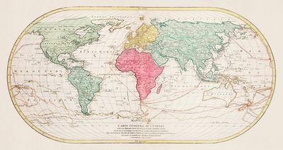


The UN has voted almost unanimously to change the traditional world map it uses to a more modern version that more accurately represents the true size of countries, particularly those closer to the equator.
We say almost unanimously, because only one country voted against the motion. That country was the US.
The vote is non-binding, but it means that international institutions around the world will now be encouraged to start using the more accurate Equal Earth map in place of the historic Mercator map that has been in use since the 16th century.
Maps are never neutral
Originally designed in 1569 by the Flemish cartographer Gerardus Mercator, the original map has been used for centuries to help European explorers traverse the planet.
But as any good cartographer will know, there is actually no fully accurate way to represent the world in 2D. However it is drawn, all maps have to make some form of compromise.
When it comes to the Mercator map, it found compromise in making the size of the countries closest to the equator smaller, while enlarging those nearest the poles. The result is that North America, Europe and Australia appear much larger than they actually are, compared to South America and Africa.
“A fair world begins with a fair map,” Robert Dussey, Togo’s Foreign Minister, told news agency Reuters.
“A map is never neutral. It shapes perceptions, influences how the place of peoples and continents in the world is understood.”
Nowhere is this more stark than in how Africa is represented. If you look at a Mercator map, you would be forgiven for thinking that the entire continent of Africa is about the same size as Greenland, when in actual fact it is an astonishing 14 times larger.
The Equal Earth map was created in 2018 to address this issue and provide a more proportionally accurate picture of our planet.
The US votes against the motion
This has all culminated in Togo, backed by the African Union members, submitting the “Correct the Map” resolution to the UN.
The vote, which happened on Friday, September 04, passed with the support of 164 nations. There were six abstentions from the vote, but only the US decided to actively vote against the motion.
Yaryna Ferencevych, the deputy US representative to the UN Economic Council, accused the UN of wasting time and resources on the vote.
“This resolution mocks the work and purpose of this institution,” Ferencevych said in a statement.
“Instead of focusing on genuine problems of international peace, prosperity, or good relations, this body is debating map projects from the 16th Century, and their role in promoting reparations and ‘cognitive justice’.”
“Resolutions like this and the ideological agenda they promote, are barnacles on our work here, and the reason this institution is losing its credibility.”
The African Union – and the rest of the world for that matter – would argue otherwise.
“This African Union initiative marks a historic step toward accurate and equitable global cartographic representation,” they said in a statement on X.
“For centuries, the Mercator projection distorted global geography… Today’s resolution promotes equal-area maps like Equal Earth across classrooms, media, and international institutions ensuring the world map finally reflects Africa’s true scale, weight, and place in the world.”