


We first brought you the psychedelic, yet ecologically accurate, work of geographer and mapmaker Robert Szucs two years ago. You may recall his colorful, high-resolution maps that showcase the flowing river basins in the US, South America, Europe, and Africa each highlighted by a different color. This time around, Szucs has gone into greater detail to characterize rivers by each state, country, and region to depict even greater geographic features such as elevation and forest cover. Naturally, IFLScience interviewed the Hungarian cartographer to better understand his work and the motivation that inspires it.
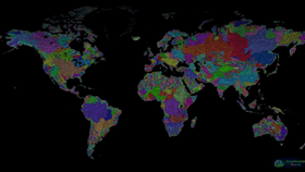
The rest of this article is behind a paywall. Please sign in or subscribe to access the full content.As we previously reported, the maps were created by using the open-source QGIS software along with data from the European Environment Agency, the Rivers Network System, and a whole lot of work. Each line shows the water as it drains from its watershed source to reach the sea, with its thickness depicting the order of stream as determined by the Strahler Stream Order Classification.
Though Szucs wouldn’t tell us exactly how he goes about processing these maps (“that’s a secret”), he told us that his art is inspired by his professional work, from archaeologists in the Caribbean to marine biologists in Portugal and Alaska to an orangutan rehabilitation center in Borneo.

IFLScience: How did you come about making these maps?
Szucs: These were basically hobby projects I worked on a couple of years ago when I had some free time. I've shared them online, people really liked them, then it all escalated really quickly. I mean, like "who are all of you people and why do you like my maps so much" quickly, within two weeks.

I: What do you hope these maps will accomplish?
S: I wanted to do justice to the beauty of nature. I've seen so many uninspiring maps over the years, especially in textbooks, I wanted to show that maps can be both beautiful and informative. I also try to support NGOs who reach out to me to use my maps for important conservation work.

I: What was your favorite map to make and why?
S: The river basins map of the contiguous 48. While I was making it, I felt that it would be something special and the map received so much love that it made me believe that making a living from my passion as an independent artist might be possible after all.

I: Other than artwork, how do you hope these maps will be used?
S: I would love them to be used in textbooks all around the world, helping the next generation fall in love with nature.
