


It may have escaped your notice, but today is rather important. As well as being World Sandwich Day and the 114th anniversary of the day SOS officially became the world standard distress signal, it's also the US election.
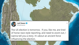
The rest of this article is behind a paywall. Please sign in or subscribe to access the full content.Whichever side of the partisan line you fall on, there's a fascinating thread on Twitter by Latif Nasser that is well worth your time, outlining how events during the Cretaceous period may still influence US elections today. How, you might reasonably ask? It all has to do with millions of tiny plankton and a blue streak in a sea of red.
In the southern states, you may have noticed that election maps tend to show it as quite, quite red, as they continue to vote Republican. However, if you zoom in closer, you'll notice a blue streak taking in parts of Arkansas, Louisiana, Mississippi, Alabama, Georgia, and the Carolinas, where Republicans cannot seem to win.
This blue streak had gone largely unnoticed, or at least unanalyzed, until 2000, when Professor Emeritus of Geoscience and Natural and Applied Sciences at the University of Wisconsin-Green Bay, Steve Dutch, took a closer look and noticed it aligned weirdly well with shorelines in Cretaceous maps of mainland North America.
So how could this ancient coastline possibly affect the elections taking place 66 million years later? Well, it ended up affecting modern demographics of the Southern states due to, you've probably guessed it, their history of slavery.
"During the Cretaceous, 139-65 million years ago, shallow seas covered much of the southern United States. These tropical waters were productive–giving rise to tiny marine plankton with carbonate skeletons which overtime accumulated into massive chalk formations," Steve Dutch explained in a piece for Deep Sea News back in 2012. "The chalk, both alkaline and porous, lead to fertile and well-drained soils in a band, mirroring that ancient coastline and stretching across the now much drier South."
The soil in this thin stretch of land became much darker and richer than soil in the surrounding regions, and the area becomes known as the "Black Belt". Here's where slavery comes in.
“The part of the country possessing this thick, dark, and naturally rich soil was, of course, the part of the South where the slaves were most profitable, and consequently they were taken there in the largest numbers," advisor to several US presidents Booker T. Washington wrote in his autobiography Up From Slavery. "Later and especially since the war, the term seems to be used wholly in a political sense—that is, to designate the counties where the black people outnumber the white.”
As for why the line only turns blue after the 1970s, Nasser writes that it was to do with voter intimidation and other prohibitive practices that kept African-Americans from voting. Despite it being illegal to deny votes to men on the grounds of “race, color or previous condition of servitude" since 1870, and women since 1920.
"Authorities made it virtually impossible: poll taxes, literacy tests," Nasser explained. "Even a pulley system that raised the ballot box out of reach of anyone not White. Not to mention intimidation and lynching."
That began to change after the hard-fought-for Voting Rights Act signed into law by President Lyndon Johnson in 1965.
From around the 1970s onwards, maps have shown that blue swoosh. But, Nasser warns, that's not the end of the story.
The rest of the thread can be seen on Twitter, and is well worth your time to delve into some history on a day that itself may well become historic.